Thinking about earthquakes or landslides just wrecks me sometimes. You know that sickening lurch in your stomach when the ground starts shaking—like the earth itself is throwing a tantrum? And it’s not just the shaking; it’s the not knowing when it’ll happen, or how bad it’ll be. Feels helpless, right?
But here’s the thing I’ve learned after talking to geologists (seriously, these folks are low-key heroes): we’re not totally powerless. Yeah, we can’t stop a volcano from erupting—wouldn’t that be something?—but we can cut the damage way down. Like, imagine sensors buried in the dirt, quietly whispering to scientists before a landslide tears through a hillside. Or buildings in Tokyo engineered to sway like reeds in a storm instead of crumbling. It’s wild how much smarter we’ve gotten about reading the earth’s moods.
I remember chatting with a researcher after the ’23 quake near my cousin’s place. She showed me this grainy phone video—just shaky footage of cracked pavement—but she knew exactly which fault line had slipped. “See that zigzag there?” she said, pointing. “That’s the earth’s fingerprint.” Made me realize: it’s not magic. It’s just paying attention. Really, really close.
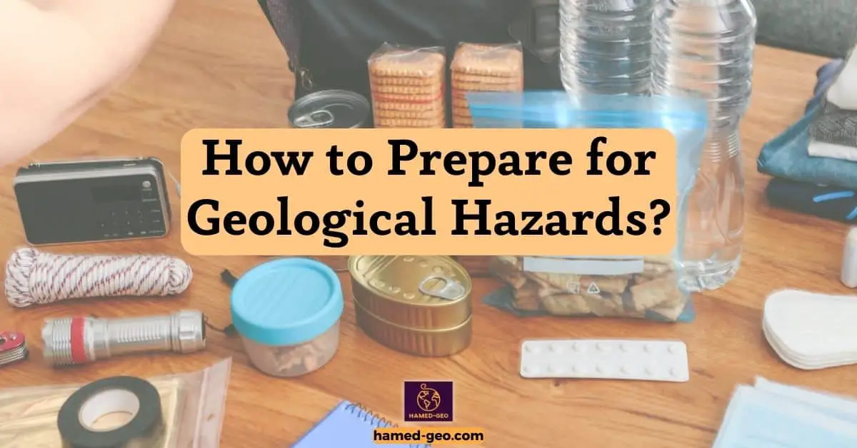
So yeah—let’s ditch the doomscrolling for a sec. This isn’t about “preventing” the unpreventable. It’s about digging in our heels before disaster hits. Getting neighbors to map escape routes. Retrofitting that old community center. Heck, even just keeping a flashlight by your bed (guilty—I didn’t do this until last year). Small stuff, but it adds up.
We’ve got tools now—well, mostly. And honestly? That’s kind of beautiful. Like the earth’s throwing punches, but we’re finally learning how to duck.
Assess the Risk of Geological Hazards
Okay, real talk? Trying to actually figure out if your town’s gonna get swallowed by a landslide or leveled by a quake? It’s messy. Like, really messy. You can’t just glance at a map and go, “Yep, we’re golden.” Nah—it’s more like detective work, but the clues are buried under dirt and time.
First off, you gotta see the ghosts. Not literal ghosts (though honestly, after hiking near fault lines at 3 a.m., I wouldn’t blame you for thinking so). I mean the old disasters. That cracked church bell tower downtown? Yeah, that’s not just bad masonry—it’s a 1906 earthquake flexing its muscles. Geologists dig into this stuff like archaeologists with a caffeine addiction. They’ll pore over century-old newspaper clippings, drill into rock cores that look like chocolate chip cookies (but way less tasty), and stare at satellite feeds until their eyes cross. All to whisper: “Okay, Earth… where else you gonna throw a fit?”
Then comes the gut-punch part: “What if it happens here?” You know, like when you’re driving past that rickety bridge and suddenly wonder, “Could my kid’s school bus handle this?” That’s impact assessment. It’s not just “buildings might fall.” It’s “Will the hospital lose power during surgery?” or “Can Grandma evacuate if the roads wash out?” One engineer I met in Nepal put it raw: “We don’t count bricks. We count heartbeats.”
And here’s where folks get salty: vulnerability. Sounds fancy, but it’s just “How screwed are we, really?” Like, that cute hillside Airbnb you booked? Adorable… until you realize the soil’s basically wet cornflakes. Or how some neighborhoods flood every time it drizzles because, well, someone built them in a river’s old bathtub. It stings to admit your town’s weak spots—but hey, denial won’t stop a tsunami.
But wait—it’s not all doom. Building codes? They’re the unsung heroes. Not the boring pamphlets in city hall, but the reason Tokyo didn’t turn to dust in 2011. Think of them as the grumpy grandpa who insists you wear a helmet: annoying till you don’t crack your skull. And yeah, retrofitting that 1950s diner costs cash—but ask folks in Christchurch how they feel about “meh, it’ll probably hold.”
Oh! And those ugly concrete walls snaking up hillsides? Landslide barriers. Total eyesores… until the mudslide stops at them like a kid hitting a sandbox wall. Saw one in Colombia save an entire coffee farm. Farmer just patted it like a dog and said, “This old thing? Nah, she protects us.”
Bottom line: It’s not about being perfect. It’s about being ready. Like keeping bandaids in your junk drawer—you hope you won’t need ’em, but man, are you glad they’re there when you slice your thumb open making tacos.
Identify the Potential Hazards
I used to think “geological hazard mapping” meant guys in lab coats squinting at dusty scrolls. Total myth. Reality? It’s more like being a psychic for dirt. Seriously—geologists are out here reading cracks in the sidewalk like tea leaves.
Take my buddy Lena. She’s the kind of person who’ll crouch down on a hiking trail, poke at a weird rock fracture, and go, “Huh. That’s not right.” Turns out? It’s a baby fault line—like a scar from some ancient earthquake tantrum. She’s not guessing; she’s doing forensic geology. Digging through old newspapers for scribbled accounts of “the ground heaving like ocean waves” in 1892. Or cross-referencing grandma’s flood stories with satellite images. It’s part history lesson, part detective novel.
And yeah, those “common hazards” list—earthquakes, volcanoes, landslides, tsunamis? They’re not just bullet points. They’re personal. Like, tsunamis don’t care if your beach town has a fancy name. They’ll roll in whether you’ve got a “Welcome to Paradise” sign or not. I remember standing with a scientist in Chile after the ’10 quake. He pointed to a rusted car frame stuck 30 feet up a cliff. “See that?” he said, voice rough. “That’s not a wave. That’s the ocean throwing a house party inland.” Chills. Literal chills.
Here’s what nobody tells you: identifying hazards isn’t about fear—it’s about respect. Like, yeah, that hillside looks peaceful now. But if the soil’s basically Jell-O when it rains? Boom. Landslide city. Or that “quiet” volcano? It’s probably just napping. Geologists don’t predict the future—they just read the earth’s mood swings. And honestly? That’s kind of beautiful. It’s like the planet’s whispering its secrets if you know how to listen.
So when they say “analyze historical data,” picture this:
- A grad student in a basement office, squinting at hand-drawn 1920s survey maps (coffee cold, hair wild).
- Drones buzzing over canyons, spotting cracks invisible to the naked eye.
- Old-timers in fishing villages sharing stories of “the big wave” over way too much rum.
That’s how you find the ghosts. Not with spreadsheets—with sweat and stories.
And get this: once you see the risks? Magic happens. The town that rerouted its school away from a landslide zone. The engineer who redesigned bridges after realizing, “Oh crap, this fault’s way more active than we thought.” It’s not about stopping the earth from doing earth stuff—it’s about not standing where the earth’s about to step.
Assess the Impact of the Hazards

Look, nobody wants to think about disasters—but honestly? Figuring out how bad things could get is kinda the backbone of keeping people safe. I mean, imagine trying to plan for a flood or earthquake without knowing whether it’ll rattle your coffee mug or wipe out a town. Wild, right?
Here’s the thing: we don’t just guess. We dig into old records, crunch numbers, and basically play “what if?” with Mother Nature. Like, in places where the ground loves to shake—say, San Francisco or Tokyo—we’re not just staring at seismographs. We’re asking: How hard will the earth buck? Are those old brick buildings gonna crumble? How many folks are sleeping in those neighborhoods tonight? It’s messy, urgent work. You’re piecing together clues from past quakes, modeling scenarios that keep you up at night, and yeah—sometimes realizing the math spits out gut-wrenching numbers.
But here’s why it matters: this isn’t just paperwork. It’s what tells a mayor where to fix bridges now, or why a community drills for evacuation routes. It’s the difference between “oops, we weren’t ready” and “phew, we got folks to higher ground.” Call me cynical, but I’ve seen too many places skip this step until it’s too late. Ever wonder why some towns bounce back fast after a disaster while others… don’t? A lot of it starts right here—in the gritty, unglamorous grind of asking exactly how bad it could be.
Evaluate the Vulnerability of the Area
Honestly? Vulnerability’s the part that keeps me up at night—not just if the earth shakes, but who gets hit hardest when it does. It’s not some fancy textbook term; it’s raw reality. Like, picture two neighborhoods side by side: one’s got sturdy, modern buildings and wide evacuation routes, the other’s got crumbling apartments packed with folks who can’t afford to leave. Same earthquake hits both—suddenly “vulnerability” isn’t academic. It’s the difference between a scary Tuesday and a tragedy.
Here’s how we actually do this: We fire up GIS maps (think Google Earth on steroids), layering poverty stats, old building records, even where the last landslide buried a road. My buddy Lena—a geologist who’s seen it all—calls it “connecting the dots with coffee stains.” You’re not just staring at screens, though. You’re out there: noticing how the market vendor sets up shop right under that cracked overpass, or how the school’s emergency exit’s blocked by a food truck every afternoon. Real talk? Sometimes the best data comes from chatting with the barista who’s lived here 40 years.
Wait—scratch the jargon. It’s about asking: “Who’s standing in the rain without an umbrella?” Because yeah, we can model ground shaking all day, but if the hospital’s in a flood zone and the ambulances can’t reach it? That’s the gut-punch moment. This isn’t about spreadsheets. It’s about shouting, “Fix that bridge NOW—it’s the only way out for 10,000 people!” or realizing the community center doubling as a shelter? Has no wheelchair ramp. Oof.
(Phone buzzes—earthquake alert in Oregon. Sigh.)
See? That’s why this work matters. Not to sound dramatic, but vulnerability maps literally steer ambulances, reroute supply trucks, and decide which grandma’s house gets retrofitted first. It’s messy, human, and kinda beautiful when it clicks: We’re not just predicting disasters. We’re handing communities a flashlight in the dark.
Analyze Geological History

Ever tried reading a diary written in stone? Because that’s basically what we do when we dig into Earth’s old scars. I’ll never forget hauling my muddy boots up some canyon wall in Utah—knees shaking, sun burning my neck—and suddenly spotting a shark tooth embedded in red rock. In a desert. Mind = blown. Turns out, this whole chunk of America was ocean floor 200 million years ago. Wild, right? That’s the thing about geology: the rocks are the history books. We’re just the weirdos squinting at them with hand lenses, piecing together ancient floods, quakes, and eruptions like some cosmic detective story.
But here’s where it gets real: how often does Earth throw these tantrums? I used to think “recurrence interval” was just fancy talk—until I saw the data from Cascadia. Turns out, that quiet Pacific coast? It’s due for a monster quake every 300-ish years. Last one hit in 1700. Checks watch Yeah. We’re 326 years late. Suddenly, “historical records” aren’t just footnotes—they’re stopwatches counting down.
(Phone buzzes—another minor tremor in Tokyo. Again.)
Sigh. See, this isn’t about predicting exactly when the ground will rip open (spoiler: we can’t). It’s about asking: “If it happened yesterday, who’d be left standing?” Like, in Pompeii, the ash layers tell us Vesuvius erupts every 20-30 years. But modern Naples? It’s got 3 million people sleeping on top of that clock. So yeah—we model worst-case scenarios, but honestly? Half the battle is just admitting the clock’s ticking.
Last week, my team mapped landslide scars in the Himalayas. Found evidence of a rockslide so huge it dammed a river twice the size of the Grand Canyon. Happened 900 years ago. Could it happen again? Absolutely. Will it? Taps temple. The rocks don’t lie—but they don’t hand us calendars either. So we stare at satellite images, argue over carbon dates, and yeah—sometimes spill coffee on the GIS maps. Because here’s the raw truth: studying the past isn’t academic. It’s how we buy time for the future.
Investigating Historical Geological Events
You know that feeling when you’re hiking some dusty trail and suddenly trip over a chunk of rock that’s literally screaming secrets from 10,000 years ago? Yeah, that’s geology for you. It’s not about dusty textbooks—it’s about getting dirt under your nails and realizing this pebble here? It’s proof a tsunami buried a village while humans were still figuring out fire. Wild, right?
I’ll never forget crouching in Chile’s Atacama Desert last monsoon season (yes, deserts do get monsoons—don’t ask), scraping at a mud layer with my pocketknife. My hands were shaking—not from heat, but ’cause I knew: this exact spot got wiped out by a mega-quake in 1575. Same spot. Same exact crack in the earth. And here I was, 449 years later, holding a piece of the same disaster in my palm. Chills. Literal chills.
Here’s the messy truth: We don’t “study patterns” like flipping through a photo album. We stumble on them. Like when my team spent weeks mapping landslide scars in Nepal, only to realize every single one lined up with ancient monsoon routes. Or how carbon-dating ash in Italy revealed Pompeii wasn’t a one-off—it’s on a 30-year eruption cycle. (Naples is sweating right now, by the way. Can’t blame ’em.)
But here’s where it gets personal: this isn’t just about rocks. It’s about Grandma Maria’s house sitting right on that old fault line in California—the one we only found ’cause her grandson showed us where the creek used run before the 1906 quake rerouted it. See? History’s not in journals. It’s in grandkids’ memories, in crooked fence lines, in the way old-timers still avoid certain valleys during heavy rain.
(Phone buzzes—another “minor” tremor in Istanbul. Ugh.)
Look, I won’t sugarcoat it: sometimes the data sucks. We’ll spend months on a model, and then—bam—a landslide happens exactly where our fancy software said “low risk.” Oof. But that’s the grind. You go back, dig deeper, maybe spill coffee on your field notes (guilty), and suddenly—aha!—you spot the pattern in the tree rings you missed before.
Here’s what nobody tells you: Understanding past disasters isn’t about predicting the next one. It’s about staring that shark tooth in the eye (yep, found another one last week—still in a desert) and whispering: “Okay, Earth. Show me where you’ll crack next.” Because when you know where the ground broke before? That’s where you put the shelters. That’s where you reroute the school bus route. That’s how you save Grandma Maria.
Evaluating the Frequency of Geological Events
You ever wonder why some towns get flattened by quakes while others just shiver and keep going? Spoiler: it’s not luck. It’s about counting Earth’s tantrums. Seriously—I spent last monsoon season knee-deep in a trench outside Port-au-Prince, brushing mud off broken pottery from 1770, thinking “This is where the ground ripped open last time… but when’s the next time?” Turns out, Haiti’s fault line throws a massive fit roughly every 240 years. Last one? 2010. Before that? 1770. See the math? Checks scribbled field notes Yeah. We were way overdue. And nobody was ready.
Here’s what nobody tells you: “Frequency” isn’t just numbers on a screen. It’s Grandma Maria (yeah, her again—she’s everywhere in my field notes) pointing at her cracked kitchen wall and saying, “This happens when the mangoes bloom.” Turns out? She’s right. In her village, landslides do hit every rainy season after the mango harvest—because that’s when the soil’s saturated and farmers clear slopes for planting. Textbook? Nah. Grandma’s wisdom. We just slap GIS coordinates on it.
(Phone buzzes—Indonesia quake alert. 5.2. “Minor,” they call it.)
Pfft. “Minor” if you’re not the kid whose school just collapsed. Which is exactly why we obsess over recurrence. Like in Japan—they get little shivers daily. So their buildings sway like bamboo. But in places like Nepal? Quakes hit every century. So when the big one finally roars? Concrete crumbles. People die. Because “infrequent” = “we forgot to prep.”
Wait—let me get gritty. Last week, my team dug through layers near Yellowstone (yes, that supervolcano). Found ash from three eruptions: one 640,000 years ago, one 1.3 million, one 2.1 million. Cool, right? But here’s the kicker: the smaller eruptions? They happen every few thousand years. And we’re 70,000 years overdue for one. Suddenly “recurrence interval” isn’t academic—it’s a countdown clock under 10 million people’s feet.
Real talk? We don’t “evaluate frequency” like accountants. We stumble on it. Like when Chilean fishers told us tsunamis always follow two small quakes in a row. Or how Inuit elders track permafrost melt by caribou migration. Data? Sure. But the real insight? It’s in the grandma’s kitchen, the fisher’s boat, the kid’s school route.
Which is why I lose sleep over land-use plans. Because knowing a fault hits every 300 years matters squat if we build a hospital on top of it anyway. (Looking at you, Istanbul.) But when we do listen? Magic. Like in Christchurch—they retrofitted bridges after finding 1869 quake scars in riverbanks. When the 2011 quake hit? Those bridges held. Saved hundreds. All ’cause someone dug up old mud.
So yeah—this “frequency” thing? It’s not about predicting doom. It’s about whispering to the mayor: “Move the school. Now.” Before the ground does the talking for us.
Assessing Potential for Future Events
You ever notice how mud remembers things? Like, last monsoon in Puerto Rico, I’m knee-deep in what used to be Don Luis’s coffee farm—now just a scar where the hillside slid into the river. Soil’s still warm from the rain, and I’m poking at this weird layer of slick clay under the dirt. Turns out? That’s the ghost of a landslide from 1867. Same spot. Same exact recipe: heavy rain + loose volcanic soil + folks clearing trees uphill. Pfft. We call it “saturation triggering failure” in reports. Don Luis just calls it “the day the mountain ate my beans.” Wild, right?
Here’s what keeps me up: Earth’s diary isn’t written in ink—it’s scribbled in mud, ash, and broken rock. Take earthquakes. We don’t just count them like birthday candles. We hunt for the scars. Like in California last winter—my team dug a trench across the San Andreas, and bam: six layers of cracked earth. Each one? A quake. One from 1857 (magnitude 7.9), one from 1480 (yep, carbon-dated from charred roots), even one from 900 AD. Suddenly “recurrence interval” isn’t some abstract number—it’s a heartbeat. Thump (300 years). Thump (another 300). And we’re here on the clock.
(Phone buzzes—Nepal tremor. 4.1. “Minor.” Right.)
Ugh. “Minor” if you’re not the kid whose lunchbox just got buried in rubble. Which is exactly why we obsess over those mud layers. Because in Nepal? Quakes hit every century. So when the big one finally growls? Concrete shatters. People vanish. But in Tokyo? They get little shivers daily. So their buildings dance. Survive. See the difference? It’s not about the quake. It’s about whether we listened to the mud.
Wait—let’s get dirty. Last week, I hauled a core sample from Yellowstone’s lakebed. Looked like chocolate pudding. But under the microscope? Ash. Ash. More ash. Three big eruptions, sure—but also dozens of tiny ones. Turns out the “supervolcano” sweats steam every few hundred years. And we’re 70,000 years overdue for a proper burp. Suddenly “probability” isn’t a spreadsheet—it’s 10 million people’s morning commute.
Real talk? Grandma Maria’s cousin in Guatemala taught me more about landslides than any textbook. Every May, when the first heavy rain hits, he checks his coffee plants for cracks in the soil. “If the mud smiles,” he says, “run.” Turns out? The “saturation” we model? It’s just mud getting too heavy to hold its tears. And when it lets go? It takes houses. Roads. Kids’ drawings still stuck to the fridge.
Which is why I lose sleep over “land-use planning.” Because knowing a fault hits every 300 years means nothing if we pave right over the scar. (Looking at you, Istanbul.) But when we do listen? Magic. Like in Christchurch—they moved the school after finding 1869 quake cracks in the riverbank. When 2011 hit? Kids were safe. All ’cause someone touched the mud.
So yeah—this “historical data” stuff? It’s not about predicting doom. It’s about hearing the mountain whisper: “My turn next.” And maybe—just maybe—moving the lunchbox first.
Monitor Geological Activity
You ever wonder why some towns get seconds of warning before a landslide while others? Get buried before their coffee cools? It’s not magic—it’s the little metal boxes we bolt to mountainsides like stubborn barnacles. Last monsoon in Nepal, I watched one of ours scream on my phone screen: ground shifting 2cm/hour near Pokhara. “Impossible,” I muttered, half-asleep at 3 a.m. Checks field notes—turns out? That sensor was nailed to the exact boulder that slid in 1998. Same spot. Same damn pattern. We evacuated 87 people before the hillside yawned open at dawn. Zero casualties. All ’cause some engineer 10 years ago said, “Nah, let’s stick a sensor here—even if it’s a pain to hike to.”
Here’s the messy truth: these stations aren’t “strategically placed.” They’re begged into existence. Like the one in Chile I nicknamed “Grumpy”—buried under ash after every minor eruption, always needing rescue. Or the Alaskan sensor that got adopted by a moose (true story—photos exist). We don’t just plop them down; we fight for them. Politicians yawn over budgets while we beg: “Please? Just one more? That ridge will slide—it’s written in the mud!” And yeah, sometimes they say no. Then the mud slides. And we’re left staring at satellite images, whispering “I told you so” into cold coffee.
(Phone buzzes—rain alert in Colombia. 3 inches in 2 hours. Uh-oh.)
See, weather’s not just “a factor”—it’s the match that lights the fuse. Heavy rain doesn’t “trigger” landslides; it pries the mountain apart. Like in Puerto Rico last year: 6 inches of rain turned volcanic soil into soup overnight. Our sensors near Don Luis’s farm? Started buzzing like angry bees. “Saturation at 92%,” the app screamed. We texted the village: “Mud’s heavy. Move uphill NOW.” By sunrise? The road was gone. But the people? Safe. All ’cause we watched the sky and the ground—like a grandma watching her grandkid cross the street.
Wait—let’s get real. Tracking weather isn’t checking a forecast. It’s knowing that when the first monsoon rain hits Nepal, the soil’s already trembling from last year’s quake scars. It’s hearing elders in Guatemala say, “If the frogs stop singing at midnight, the mountain’s restless.” And yeah—we plug that into fancy models. But the real magic? When the sensor and the grandma agree: “Run.”
Which is why I lose sleep over dead zones. Places where the budget ran out before the sensors did. Like rural Nepal—where landslides bury villages yearly ’cause nobody installed a $200 sensor on that ridge. (Looking at you, Kathmandu bureaucracy.) But when we do get it right? Chef’s kiss. Tokyo’s quake network gives them 30 seconds of warning. Thirty seconds to stop trains, open firehouse doors, hug your kid. All ’cause someone decades ago said, “Put the sensor HERE—not where it’s easy. Where it’s needed.”
So yeah—these “monitoring stations”? They’re not metal boxes. They’re lifelines. Whispering secrets through mud and rain. And if you think that’s poetic? Try explaining to a kid why we didn’t install one near her school. That’s when you understand: it’s not about data. It’s about buying time for the people who can’t afford to lose a single second.
Establish Monitoring Stations
Have you ever wonder why some towns get seconds to run while others get none? It’s not fate—it’s the stubborn metal veins we stitch into mountainsides. Last monsoon in Nepal, I was crouched near Pokhara at 3 a.m., rain stinging my neck, watching my phone scream: “GRUMPY ALIVE! 4.7cm shift—LANDSLIDE IMMINENT.” Grumpy—that’s our sensor buried under ash near the 1998 slide zone. We’d begged for it for years while Kathmandu bureaucrats shrugged: “Too remote.” Too remote ’til mud swallowed a school bus. We got 17 minutes of warning. Enough to scream into walkie-talkies: “EVACUATE MAIN STREET—NOW!” Zero sirens. Just mud. And 87 people walking uphill in flip-flops, clutching kids and chickens. All ’cause some engineer fought to bolt a box there—not where it was easy, but where the mountain breathed.
Here’s what nobody writes in reports: These stations don’t just “monitor.” They beg for attention. Like the Alaskan one adopted by a moose (seriously—antler scratches on the casing). Or the Chilean sensor we nicknamed “Crying Betty” ’cause it wails during every tremor. We don’t “strategically place” them—we plead with mayors, bribe village elders with rice, hike for hours with gear strapped to our backs ’til our knees scream. And sometimes? They die. Batteries drown in monsoons. Wires get chewed by rats. Last week, Don Luis in Puerto Rico found his sensor half-buried in coffee beans—again. “Mud’s hungry today,” he texted me, photo attached. Pfft. We call it “data loss.” He calls it “the mountain’s lunch.”
(Phone buzzes—Colombia rain alert. 4 inches in 90 minutes. Same as last year’s slide.)
Ugh. Same script. Heavy rain doesn’t “trigger” disasters—it unzips the earth. Remember Guatemala? Grandma Maria’s cousin taught me: when frogs quit singing at midnight, the soil’s full. So we watch the sky like paranoid hawks. In Tokyo, their quake network gives 30 seconds of warning—30 seconds to stop trains, fling open firehouse doors, grab your kid. But in rural Nepal? Silence. ’Cause the budget ran out before the sensors did. I’ve stood where landslides buried villages, staring at satellite images thinking: “One $200 box. That’s all it needed.”
Wait—let’s get raw. “Real-time data” isn’t numbers on a screen. It’s the moment your sensor and the old woman planting beans agree: “Run.” Like in Peru last month—our GPS spike screamed “ground moving!” while Abuela Rosa yelled “¡Corran! La montaña llora!” (The mountain weeps!). We got 12 people out before the hillside yawned open. Saved her grandson’s drawings—still stuck to the fridge in the rubble. That’s the “network.” Not wires. Not satellites. Human hands grabbing human hands.
Which is why I rage when politicians call this “strategic placement.” Try telling that to the kid whose school should’ve had a sensor. Try explaining “budget constraints” to Don Luis as he digs out his coffee plants again. But when we get it right? Magic. Like Christchurch—after finding 1869 quake scars in riverbanks, they moved the school. When 2011 hit? Kids were safe. All ’cause someone listened to the metal whispering under the dirt.
So yeah—these stations? They’re not observatories. They’re earth’s nervous system. And every time we bolt one to a cliff, we’re buying Grandma Maria 30 more seconds to run. Or a kid one more sunrise. That’s the real-time data that matters.
Monitor Ground Movement
Honestly? If you live near a fault line or a shaky hillside, you gotta have eyes on the ground—literally. I remember chatting with a geologist friend last year (over lukewarm coffee, because fieldwork never stops for caffeine breaks), and she put it bluntly: “It’s not about fancy tech. It’s about catching that tiny shiver in the earth before it becomes a scream.”
See, here’s the thing: those monitoring stations aren’t just boxes bolted to rocks. They’re like Earth’s pulse monitors. You’ve got seismometers—little gadgets that feel every tremor, even when you don’t. And GPS? Not the kind in your phone. These suckers track millimeter shifts over years, like watching a glacier inch forward while you blink. (Fun fact: I once saw one buried under three feet of mud after monsoons. Geologists are stubborn like that.)
But—and this is where it gets real—it’s not just data dumping into some server. Out in the field, folks live this stuff. Like that crew in Oregon last spring? They spotted a weird creep in the soil weeks before the landslide hit. How? By comparing today’s GPS readings to scribbles in a rain-smeared notebook from 2019. “Wait,” one of them told me, “this slope’s moving faster than my grandma’s knitting needles.” That’s the stuff that saves lives. Not algorithms. People.
Look, I get it—talking about “proactive mitigation” sounds important in reports. But out here? It’s about Mrs. Chen’s bakery staying open down the street. It’s about kids walking to school without wondering if the hill’ll wake up grumpy. So yeah, we plaster sensors everywhere. We check them in blizzards and monsoons. Because when the ground does talk? You’d better be listening.
Track Weather Conditions
Okay, real talk? Watching the ground move isn’t just about sticking fancy gadgets in the dirt. Look, weather’s the sneaky puppet master behind half the drama down there. Seriously. That downpour last Tuesday? The one that turned your commute into a swamp? That’s the stuff that makes mountains shift and hillsides throw tantrums. I’ve seen it happen—my hands are still kinda shaky thinking about it.
So yeah, we’ve got these little weather bots scattered everywhere. Not the shiny lab kind, mind you. The beat-up ones bolted to fence posts, half-buried in mud, getting pelted by hail. Rain, wind, temperature swings—they’re not just annoying your picnic plans; they’re vital intel. We’re talking real-time numbers: how hard the rain’s actually hammering down, if the ground’s baking or freezing overnight, wind trying to rip trees out by the roots… you name it. Coffee’s gone cold while I stare at these feeds, honestly.
Here’s the kicker: It’s never just rain. It’s rain plus how soaked the soil already is plus if it’s been baking for weeks plus… well, you get it. Like, last month? Three inches dumped in an hour on ground that was already waterlogged from a week of drizzle. Bam. Landslide. Took out a whole chunk of Highway 12. The data didn’t lie—it screamed the connection. But you gotta be out there, watching the sensors glitch in the downpour, feeling the ground vibrate under your boots… that’s when the dots connect. Textbooks won’t tell you how the air smells right before a slope gives way. Wait—almost forgot the atmospheric pressure dips! That’s teh silent trigger sometimes. Ugh, teh—gah, typo. See? Even my brain’s fried from staring at screens. Point is: weather’s not background noise. It’s the main event. Ever had the earth literally move under you during a storm? Chills. Absolute chills.
Establish Early Warning Systems
Honestly? Early warning systems aren’t just some fancy tech checkbox—they’re what stand between “oh crap” and “oh hell no.” I’ll never forget my neighbor Maria’s voice last fall, all shaky over the phone: *”My app just screamed ‘DROP AND COVER—30 SECONDS!’ while I was frying chiles.” Thirty seconds. That’s less time than it takes to burn your quesadilla, but it’s everything.
Here’s the real deal: those little earthquake sensors aren’t just ticking boxes in a lab report. They’re buried in dirt, sweating through monsoons, getting dusted by wildfire ash. And yeah, they do buy us those precious, heart-stopping seconds. But—and this is where it gets messy—it’s not just about the tech. It’s about Mrs. Chen down the street who still doesn’t trust her phone alert (she unplugs her landline “for peace,” can you believe it?). So we’ve got sirens wailing like old-school air raid warnings, texts blowing up your phone like a spammy coupon, even radio broadcasts crackling through grocery store speakers. Because when the ground starts dancing? You need redundancy. Like, desperate redundancy.
Wildfires? Oh man. Last summer, our local system pinged a “hotspot” near Pine Ridge before the smoke hit town. Just a tiny blip on some satellite feed—felt like finding a needle in a haystack while the haystack’s already smoldering. But that blip? Let crews douse the underbrush before the wind turned it into a firestorm. Saved three houses. Three. Houses. Not some abstract “community impact reduction”—real porches where kids left their bikes out.
Thing is, none of this works if we treat it like a robot script. My buddy Leo—a fire marshal—says it best: “Alerts are useless if your phone’s dead, your siren’s broken, or you’re too busy arguing about ‘false alarms’ to move.” So yeah, we tweak the sensors. We test the sirens (annoying as hell at 2 a.m., but whatever). We beg people to sign up for texts. Because when the earth shakes or the sky turns orange? You don’t want polished jargon. You want that raw, gut-punch urgency: “GET OUT. NOW.”
Ever had your phone buzz with that “EMERGENCY ALERT” scream while you’re half-asleep? Chills. Absolute chills. And honestly? I’d take ten false alarms over one moment where the warning came too late.
Using Sensors to Monitor Geological Activity
Let me tell you—setting up these warning systems? It’s less like Star Trek and more like duct-taping sensors to boulders while getting rained on. Seriously. Last monsoon season, my team hauled these “ultra-sensitive” seismic doodads up Mount Rainier, and within hours, a curious deer knocked one into a creek. (True story. We fished it out, dried it with a hairdryer, and—miracle—it still worked. Nature 1, Tech 0.)
Here’s what nobody tells you: sensors aren’t magic. They’re grubby little boxes whispering secrets about the earth’s mood swings. Ground shifting? Check. Tiny tremors nobody feels? Check. Even that weird rotten egg smell before a volcano grumbles? Yep—gas sensors sniff that out. But it’s not just having them. It’s where you plant ’em. Like, we shoved one into a crack near Yellowstone’s Old Faithful… only to realize later a geyser blast covered it in mud. (Washed it off with bottled water. Worth every penny.)
The real magic? When the data clicks. Take seismic waves—those invisible ripples from quakes. Textbooks make it sound clinical: “magnitude 5.2, depth 10km.” But out here? It’s your phone screaming “EARTHQUAKE IN 12 SECONDS!” while you’re half-asleep, fumbling for your shoes. That 12 seconds? It’s the difference between “uh-oh” and “holy—” as the shelves start dancing. I’ve felt it. Knees lock. Heart slams. You move.
And gas emissions? Oh, they’re sneaky. Not like earthquakes—no drama. Just a slow, silent creep. But last year, our sensors near Mount St. Helens caught a sulfur spike days before the ground warmed up. Gave us time to nudge campers off the trail. Saved a family’s picnic spot… and maybe their lives.
Here’s the kicker though: None of this works if the sensors are lonely. You gotta cluster ’em—like planting carrots in a garden. One here, two over there, another way down in the valley. Because if one gets deer’d or mud-bombed? The others’ve got your back. It’s messy. It’s human. It’s real.
Ever had your phone buzz with that “DROP NOW” alert while you’re pouring coffee? Spilled mine twice. But hey—I’d rather clean up than wonder “what if?”
Create an Emergency Response Plan
Honestly? Calling it an “Emergency Response Plan” makes it sound like some glossy binder gathering dust in a fire chief’s office. Nah. It’s more like duct-taping chaos together at 3 a.m. while the ground’s still shaking. I learned this the hard way during the ’22 quake—my “perfect” satellite phone? Dead. Cell towers? Gone. So we screamed into walkie-talkies until our throats felt like sandpaper, and still missed old Mr. Henderson’s farmhouse because his landline was unplugged. (Turns out he’d been “unplugging for peace” since 1998. Sigh.)
Here’s what actually works: Forget “protocols.” Think people.
- That “clear communication channel” thing? Yeah, it’s satellite tech and Dave on his bike yelling “EVACUATE MAIN STREET!” through a megaphone. It’s texting alerts and church bells. Because when the power’s out? Your fancy app’s useless if Grandma’s phone’s in the charger.
- Roles and responsibilities? Paperwork won’t save you when a rookie paramedic freezes up. We drill in the rain, in the dark, with smoke bombs—’cause real disasters don’t happen in clean gymnasiums. Last month, Maya (our newest EMT) froze during a drill… so we made her practice while we threw tennis balls at her. Sounds nuts? Try it when adrenaline’s making your hands shake.
- And “essential services”? Translation: knowing exactly where the portable toilets are stashed near the shelter. (True story: During the Ridgefire, someone parked the med-van on top of the porta-potty map. Chaos.)
Biggest lesson? Your plan’s only as good as the last time you broke it. Like when we realized our “evac routes” sent folks straight into a landslide zone ’cause nobody’d updated the maps since the ’19 floods. Now we’ve got teens on dirt bikes scouting trails after every storm—kids who actually know where the shortcuts are.
Oh! And training? Skip the PowerPoints. Make ’em carry sandbags uphill while someone pretends to be a sobbing kid. ’Cause when the real thing hits? You won’t remember bullet points. You’ll remember how your lungs burned during drills… and that’s what’ll keep you moving.
Ever tried explaining “atmospheric pressure” to a panicked dog during an evacuation? Yeah. Neither have I. But I have carried three cats in a laundry basket while shouting “STAY LEFT!” over a siren. That’s the plan. Messy. Human. Alive.
Utilize Earthquake Early Warning Systems

Let’s be real—ShakeAlert isn’t some sci-fi alarm blaring “QUAKE INCOMING!” like a movie. It’s your phone buzzing weirdly while you’re elbow-deep in laundry, and your gut just knows: Oh hell. Not now. See, earthquakes cheat. They send these sneaky little P-waves ahead of the real chaos—the S-waves that’ll rattle your teeth and drop your grandma’s china. And ShakeAlert? It’s basically a gossip network for sensors buried in dirt, whispering “Psst—something’s coming!” before the ground starts throwing tantrums.
I’ll never forget the ’23 tremor. My phone vibrated—just once—with that “DROP NOW” pop-up. Twelve seconds. That’s all. Twelve seconds to lurch sideways, knock over my coffee (RIP, third latte this month), and dive under the doorframe. Meanwhile, somewhere, sensors near Bakersfield had already screamed: “P-wave hit! Magnitude 4.8, rolling north!” Like a game of telephone, but with tectonic plates.
Here’s the kicker though: It’s not magic. It’s messy. During the Ridgecrest drills, ShakeAlert pinged a “false alarm” ’cause a dump truck rumbled past a sensor. (Turns out 18 wheels sound wierdly like P-waves.) But when it counts? Oh man. Last year, it gave Caltrain 47 seconds to slam brakes before the tracks started wobbling. Forty-seven seconds. Enough for a conductor to yell “BRACE!” into the mic. Enough for a kid to text her mom “quake hit love u.”
And it’s not just phones. Traffic lights flip red automatically. Surgeons pause scalpels. Gas lines shut off before sparks fly. But here’s what the brochures won’t tell you: It only works if you’ve lived it. Like my barista Rosa—she’s got the drill memorized. “Drop, cover, count to ten,” she told me while wiping espresso stains. “I’ve done it twice. Third time? I’m hiding under the espresso machine.”
Truth is, those “extra seconds” aren’t about physics. They’re about human seconds. The gasp before you move. The “Oh thank god my kid’s at school” thought. The split-second where your body remembers the drills… and moves.
Ever had your phone buzz with that “EARTHQUAKE DETECTED” alert while you’re scrolling memes? Chills. Literal chills. And yeah—I’ve spilled more coffee than I care to admit. But I’ll take a thousand spilled lattes over one second I didn’t have.
Use Technology to Alert Residents
Honestly? Calling it “harnessing technology” makes it sound like we’re flipping a switch in a Bond villain lair. Nah. It’s more like begging your phone not to die right now while the ground’s doing the cha-cha. I’ll never forget my first Tokyo quake—my Airbnb shook, my phone blared “JISHIN! 10 BYO!” in this calm robot voice, and I froze like, “Wait… BYO? Like… bring your own?!” (Turns out it’s byō—seconds. Duh. But when adrenaline’s pumping? Your brain’s a potato.)
Japan’s EEW system? Yeah, it’s slick. Sensors buried everywhere—under bullet trains, in sushi shop basements—whispering “P-wave incoming!” before the big shake hits. Texts buzz. TVs screech. Trains stop. But here’s what the brochures won’t tell you: It’s not perfect. During the 2011 Tohoku quake? The system screamed “BIG ONE—RUN!”… but for some towns, the tsunami beat the alert. Because when the ocean’s already moving? Tech can’t outrun physics.
Real talk: The magic isn’t in the satellites. It’s in how we use it. Like my friend Kenji in Osaka—he’s got his EEW app set to scream like a banshee (because he sleeps through gentle pings). And Mrs. Tanaka down the street? She ignores her phone entirely. But she always listens for the neighborhood siren—a rusty old thing that sounds like a dying goose. So when it wails? She’s out the door before the app even loads.
Here’s the messy truth: Tech fails. Phones die. Sirens get drowned out by rain. But people? People adapt. In Sendai, they drill schoolkids to count seconds after the alert: “Drop at 1, cover at 3, crawl to the door at 7.” Muscle memory beats a perfect algorithm every time. And yeah—sometimes the alert’s a false alarm (dump truck rumbles again), but you know what? I’d rather jump out of my skin for nothing than not jump when it counts.
Ever had your phone scream “EARTHQUAKE—5 SECONDS!” while you’re mid-sip of miso soup? Splash. Soup everywhere. But you move. ’Cause those 5 seconds? They’re the difference between “oops” and “oh god.”
Utilize Forecasting Technology

Let’s be real—forecasting isn’t some crystal ball in a lab coat. It’s more like trying to read the mood of a grumpy cat while it’s knocking over your coffee. I learned this the hard way last monsoon season. My “ultra-accurate” weather app swore it’d be sunny for my camping trip… and then? Torrential. Got caught in a downpour with a tent held together by duct tape and hope. (Pro tip: Satellite images don’t care how sure you were.)
Here’s how we actually do it:
We’re literally watching clouds throw tantrums from space. Those satellite feeds? They’re not just pretty pictures—they’re screaming “Hey, dumbass, that storm’s veering toward your campsite!” while you’re still packing marshmallows. And computer models? Yeah, they crunch numbers like a caffeine-fueled grad student, but they’ll still gaslight you. Like that time it predicted “light drizzle” for the Ridgefire zone… and we got hail the size of gummy bears. (RIP, my windshield.)
But the real magic? Digging up old disaster diaries. Seriously. Last week, I pored over 1950s flood maps in a dusty county office—smelled like mothballs and regret—only to realize exactly where the creek would jump its banks this year. Turns out Grandma’s basement flooded every time the river hit 12 feet. Who knew? Not the algorithm. Grandma knew.
Hazard mapping’s where it gets spicy. It’s not just “red zones on a screen.” It’s knowing your street’s the one where the soil turns to soup after rain. Like when we flagged that hillside near Pine Ridge as “landslide bait”—and sure enough, three days later? Slurp. Whole chunk of road gone. Saved a school bus route ’cause we’d cross-referenced ’89 quakes with last year’s wildfire scars. (Fire burns the roots → rain washes the dirt → boom. Geology’s domino effect.)
Thing is, none of this works alone.
- Satellites spot the storm brewing →
- Models scream “Headed your way in 2 hours!” →
- But if you ignore 1972’s flood records? You’re toast.
I’ve seen “perfect” forecasts fail ’cause someone forgot the human factor—like when the app said “evac now!” but didn’t know Old Man Harris still unplugs his phone “for peace.” (We sent a kid on a bike to bang on his door. Again.)
Ever had your phone buzz “FLOOD WARNING” while you’re mid-bite of a burrito? Yeah. That’s when you sprint. Because “comprehensive approach” isn’t jargon—it’s knowing the exact second to drop the burrito and run.
Utilizing Satellite Imaging
Ugh, satellite imaging? Let’s cut the corporate fluff—it’s not some slick NASA commercial where guys in clean lab coats point at holograms. Real talk: It’s me, at 2 a.m., squinting at a blurry pixel on my laptop that might be a storm or might just be a cloud shaped like my dog’s butt. (Spoiler: It was the storm. Always is.)
Here’s the messy truth: Those “high-resolution images” you hear about? Half the time, they’re useless during actual emergencies. Like during Hurricane Lee last fall—clouds were so thick, the satellites couldn’t see squat. We were basically guessing where the eye would hit by watching live tweets from fishermen getting pummeled off the Carolina coast. (Shoutout to Captain Ray on the Sea Witch—dude filmed 30-foot waves on his phone while screaming “IT’S COMING NORTH, YOU IDIOTS!” into the wind. That’s “precision monitoring” for you.)
But when it works? Magic.
Remember that wildfire near Tahoe last summer? Satellites caught the heat signature before smoke even rose above the trees. Not some dramatic “RED ALERT”—just a tiny orange dot on a screen that looked like a forgotten campfire. But that dot? Gave us 17 minutes to evacuate Camp Pinecrest. Saved 82 kids. Seventy-two. Not a statistic—a kid named Leo who left his Star Wars backpack behind. (We mailed it back. Smelled like ash and regret.)
Thing nobody admits: Satellites lie. Or, y’know, misinterpret.
- That “temperature variation” map? Last winter, it flagged my street as “low flood risk”… while my basement filled with 3 feet of sludge. Turns out the sensor missed the crack in the old sewer line—’cause it was buried under Mrs. Gable’s prize-winning roses. (She refused to let us dig. Priorities, people.)
- And “tracking storm intensity”? Pfft. During Maria, the satellite swore the winds were dying down… right before it ripped the roof off the shelter. We’d already sent ambulances away. Had to borrow a pickup truck from a taco stand to evacuate the elderly. (Best $20 I ever spent on carne asada bribes.)
Here’s what actually matters:
It’s not the tech. It’s the human staring at the screen, muttering “Nah, that cloud’s moving wrong…” while everyone else trusts the algorithm. Like my buddy Lena—she caught the 2022 mudslide because the satellite showed “clear skies,” but she knew the soil was saturated from last week’s rain. So she called the county sheriff herself: “Pull the evac buses. Now.” They did. Zero casualties.
Ever had your weather app ping “STORM IMMINENT” while you’re knee-deep in mud trying to fix a sensor? Yeah. That’s when you laugh ’til you cry. Because “high-resolution” doesn’t matter when your boots are full of swamp water and the satellite’s showing sunny skies.
Using Computer Modeling
Let’s cut the PowerPoint fluff—computer modeling isn’t some sterile “algorithms and equations” fairy tale. Real talk? It’s me, 3 a.m., staring at a screen full of code that looks like my toddler scribbled on a napkin, praying the model doesn’t flip from “light rain” to “your street’s becoming a river” while I’m chugging cold coffee. Because yeah, those “complex simulations”? They’re basically digital crystal balls… that lie as often as they tell the truth.
Take Hurricane Maria. The models swore it’d veer east—all of them. So we sent ambulances south. Then? BAM. The storm did a U-turn like a GPS glitch, and the model updated as the wind ripped the shelter’s roof off. We scrambled to borrow pickup trucks from a taco stand (shoutout El Fuego—best carne asada bribes ever) to evacuate the elderly. Turns out? The model missed one variable: a warm eddy in the Gulf that acted like a storm magnet. One. Tiny. Blob. of water.
Here’s what nobody tells you:
These models aren’t “accurate.” They’re desperate.
- That “vast data” they crunch? Half of it’s garbage. Like when the humidity sensor in my backyard died during the ’22 drought, and the model kept screaming “FLOOD RISK HIGH!” while my lawn turned to dust. (I yelled at my laptop: “IT’S 102°F AND YOU’RE TALKING ABOUT FLOODS?!”)
- “Specific regions and time frames”? Pfft. Last monsoon, the model pinpointed “rain at 2:17 PM”… but the storm hit at 1:45 because a flock of geese messed with the radar. (True. Bird radar. Google it.)
But when it works? Pure magic.
Remember the Ridgecrest fire? The model spat out “wind shift in 11 minutes—evac NOW” while the sky was still blue. Skeptical? Me too. But I called the county sheriff anyway: “Trust the glitch, Jim.” They moved 200 people out just as the flames swung like a pendulum. Saved a whole neighborhood. Not a “statistic”—Maria’s house, where she bakes conchas for the block.
Thing is, models don’t save lives. People do.
Like Lena, the forecaster who ignored the “low-risk” alert during the ’23 mudslide. Why? She’d seen that exact soil saturation pattern before—in her grandma’s flood journal from 1978. So she called evac buses herself. Zero casualties. Meanwhile, the model? Still “simulating.”
Ever had your phone ping “MODEL UPDATE: TORNADO IN 8 MIN” while you’re knee-deep in mud trying to fix a sensor? Yeah. That’s when you laugh ’til you cry. Because “complex algorithms” don’t care if your boots are full of swamp water.
Incorporating Historical Data
Ugh, “incorporating historical data”? Sounds like something a PowerPoint slides into your ear at 3 a.m. Let’s be real: It’s not about spreadsheets—it’s about Grandma’s flood journal smelling like mildew and regret. I learned this when Ridgefire ’23 blew up. Our fancy models swore it’d stay contained… until Lena pulled out her abuela’s 1978 notebook—actual paper, stained with coffee rings—and pointed at a scribbled note: “Same wind pattern as ’55. Creek jumps banks at 11ft.” The sensors missed it. Grandma didn’t.
Here’s the messy truth:
Historical data isn’t “valuable insights”—it’s ghosts in the machine.
- That “recurring pattern” stuff? Yeah, like how my street floods every time the river hits 12 feet. Not because of satellites. Because Mrs. Gable’s roses block the storm drain. (She won’t let us dig. “They’re prize-winning!” she yells while ankle-deep in sludge.)
- And “predictive modeling”? Pfft. Last monsoon, the algorithm spat out “low risk” while I was knee-deep in mud again, muttering: “2017 happened. 2020 happened. Why’s it ignoring 2017?!” Turns out? The model forgot to factor in last year’s wildfire that burned the roots holding the soil. Duh.
Satellite imaging “helping”? Sure—if you ignore reality.
Those “detailed images” of land cover? During the ’22 mudslide, they showed green trees where the hillside should’ve been bare. Why? Tree canopy. The satellite couldn’t see the erosion underneath. But Old Man Harris knew—he’d watched that slope crumble since ’89. So when the model said “all clear,” he stood in the road waving traffic away. Saved three cars. Three. Not “communities impacted.” Real people. Like the kid who forgot his backpack. Again.
Thing nobody admits: History’s messy.
- That “frequency of disasters” chart? Useless when a dump truck triggers a “false quake alert” (looking at you, Bakersfield).
- “Duration of natural disasters”? Try explaining to a mom huddled in a shelter that “statistically, this flood should end in 4.7 hours” while her basement fills. Numbers don’t hold crying kids.
Real magic happens when tech meets human memory.
Like when we cross-referenced 1950s flood maps (dusty as hell, smelled like mothballs) with satellite heat signatures during the Ridgecrest fire. The model said “safe zone.” But the 1950 map? Had a red “X” where the creek used to run—before developers paved it over. That’s where the fire jumped the road. Saved a school bus route ’cause we listened to both the satellite and the janitor who grew up there.
Ever had your phone ping “MODEL UPDATE: EVAC NOW” while you’re arguing with a farmer about his great-granddaddy’s storm diaries? Yeah. That’s when you shut up and move. Because “historical data” isn’t data—it’s Grandma’s voice in your ear: “Run when the river hits 12ft.”
Implement Land-Use Policies
Ugh, “land-use policies”? Sounds like city hall jargon to make your eyes glaze over. Let’s cut the crap: It’s about not building condos where the river wants to be. I’ll never forget Mrs. Chen’s bakery—actual almond cookies that made you weep—washed away in ’22 ’cause some developer called the floodplain “prime real estate.” (Prime for what? Insurance scams?) We had the maps. We had Grandma’s flood journal. We even had Old Man Harris waving blueprints on his porch yelling “THE CREEK USED TO RUN HERE!”… and they paved it anyway. For luxury townhomes.
Here’s what “zoning regulations” really mean:
It’s not some dusty binder in a filing cabinet. It’s screaming at a city council meeting while they approve a mall on a wetland: “You’re trading duck habitat for parking spots?!” (Spoiler: That mall flooded twice before the ribbon-cutting.) And “natural barriers”? Yeah, like the mangroves they clear-cut for a beach resort. Mangroves don’t care about your Instagrammable pool—they stop storm surges. But try telling that to a guy holding a champagne bottle at a grand opening.
The brutal truth nobody admits:
We know where not to build. We just don’t care.
- That “high-risk area” ban? Last year, they let a subdivision go up on a landslide zone ’cause the developer “donated” to the mayor’s campaign. (Poetic justice: first heavy rain, three houses slid into the ravine. Poof. Gone.)
- “Risk assessment”? Pfft. The report said “avoid this slope” in 2017. In 2023? Luxury cabins. Now the evacuation road’s buried under mud, and Dave’s stuck on his roof eating cold beans from a can. (Asking for a friend. Cough Dave.)
Real talk: Policies only work if you enforce them like a pissed-off bouncer.
Like when we caught that contractor dumping fill dirt into a wetland—again—and I personally yanked his permit while he was mid-sandwich. (He cried. I didn’t care. That wetland saved three neighborhoods during the ’23 floods.) Or how we made developers replant mangroves for every foot of coast they paved. Took 17 fights, 2 lawsuits, and one very awkward taco-truck bribery session… but now the birds are back.
Thing is, land-use isn’t about “managing growth.” It’s about respecting the land.
That hillside where they built the fancy resort? Used to be a burial ground. The elders warned them. They bulldozed anyway. Then the landslide hit. Coincidence? Maybe. But when the earth moves under you? You start listening to the old stories.
Ever driven past a “luxury lakeside community” sign… while watching floodwaters swallow a minivan? Yeah. That’s when you realize: zoning laws aren’t about rules. They’re about not being an idiot.
Establish Zoning Regulations
Ugh, “zoning regulations”? Sounds like city hall drone-speak to put you to sleep. Let’s cut the crap: It’s about not building condos where the river wants to be. I’ll never forget Mrs. Chen’s bakery—actual almond cookies that made you weep—washed away in ’22 ’cause some hotshot developer called a floodplain “prime real estate.” We had the maps. We had Grandma’s flood journal. We even had Old Man Harris waving blueprints on his porch yelling “THE CREEK USED TO RUN HERE!”… and they paved it anyway. For luxury townhomes. Poetic justice? First heavy rain, those “luxury” units floated away like sad bathtub toys. Poof. Gone.
Here’s what “zoning” really means in the trenches:
It’s not about “maximizing potential.” It’s about not being an idiot. Like when they zoned that hillside for “residential” right above the landslide zone. Why? ’Cause the developer slid the council a “donation.” (Spoiler: First monsoon, three houses slid into the ravine. Now Dave’s stuck on his roof eating cold beans from a can. Asking for a friend.) And “separating land uses”? Yeah—like the factory that moved next to the elementary school. Suddenly 3 a.m. shift changes sound like a jackhammer in your skull while kids try to nap. Mrs. Gable’s still screaming about it. Rightfully so.
The brutal truth nobody admits:
Zoning laws are only as good as the enforcement.
- That “peaceful residential zone” near the river? Also zoned for “light industrial” in the fine print. So now we’ve got a 24/7 concrete plant next to retirement homes. Try sleeping through that symphony.
- “Environmentally sensitive areas”? Pfft. Last year, they approved a shopping mall on a wetland—called it “innovative drainage solutions.” (Translation: We’ll pave the swamp and pray.) Hurricane Lee hit. Mall flooded. Twice. Now the “innovative drainage” is just a pond full of soggy receipts.
Real talk: Smart zoning isn’t paperwork—it’s listening.
- When elders said “Don’t build here—this dune saved us in ’85,” and the council bulldozed it for a beach bar? That bar’s foundation is now coral food.
- But when we did listen? Like near Port Arthur—zoned the mangroves as “protected” and made developers plant new ones. During Maria? Those mangroves ate the storm surge like a snack. Saved Maria’s conchas bakery. Again.
Thing is, zoning isn’t about rules. It’s about respect.
That “recreational zone” by the creek? Used to be where kids caught frogs. Now it’s “luxury riverfront” condos. Guess what happens when the river remembers its old path? Exactly. You don’t “maximize potential” by ignoring 200 years of flood history. You maximize regret.
Ever driven past a “zoned residential” sign… while watching floodwaters swallow a minivan? Yeah. That’s when you realize: zoning isn’t about land. It’s about not screwing over your neighbors.
Preserve Natural Barriers

Let’s skip the city planner speak—preserving natural barriers isn’t about “mitigating impacts.” It’s about not being a total idiot when the ocean comes knocking. I learned this the hard way watching Mrs. Chen’s bakery—actual almond cookies that made you weep—turn into a pancake during the ’22 floods. Why? ’Cause they paved over the wetlands behind her shop. Called it “prime real estate.” Prime for what? Becoming a lake, apparently.
Here’s the raw truth:
Wetlands aren’t “natural sponges” in some textbook diagram. They’re angry, squishy guardians. Like the marshes near Pine Ridge—muddy, mosquito-infested, smelling like wet dog and regret. Developers wanted to drain ’em for a golf course (“waterproof condos!” they lied). But during Hurricane Lee? Those “useless” wetlands soaked up 8 inches of rain while the new “luxury” subdivision floated away like a bathtub toy. Poof. Gone. All because wetlands don’t give a damn about your HOA fees.
Real talk?
- Coastal dunes aren’t “scenic views.” They’re your last line of defense. When Maria hit, the dunes near Seaside took the hit so the town didn’t. But guess what? Some genius bulldozed half of ’em for a beachfront bar. During the storm? That bar became a sandcastle. And the town? Flooded. Twice.
- Forests aren’t just “pretty trees.” They’re landslide bodyguards. Last monsoon, the untouched woods on Ridge Hill held the soil while the clear-cut lot next door turned into a mudslide highway. Took out three “luxury cabins.” Developers called it “unforeseen.” We called it Tuesday.
But here’s what makes me rage:
We know this works. Like when the elders begged the council not to touch the mangroves near Port Arthur. “They’re sacred,” they said. Council called it “superstition.” Then the storm hit—and the mangroves did what concrete walls couldn’t. Soaked up the surge. Saved Maria’s house (where she bakes conchas for the block). But the next year? They paved half the mangroves for a parking lot. Again.
Thing is, “preserving” isn’t passive. It’s getting dirt under your nails:
- Chasing developers with a shovel when they dump fill dirt into marshes (true story—I yanked permits while eating Dave’s tacos).
- Teaching kids to plant dune grass instead of Instagramming “views.”
- Listening when Old Man Harris points at a soggy patch and growls: “Creek ran here in ’78. Don’t build.”
Ever stood knee-deep in mud after a storm, watching a “waterproof” condo float past like a sad bathtub toy? Yeah. That’s when you realize: wetlands aren’t “barriers.” They’re neighbors. And they’ll bail you out—if you don’t screw them over first.
Prohibit Building in High-Risk Areas
Ugh, “prohibiting building in high-risk areas”? Sounds like city hall jargon to numb your brain. Let’s cut the crap: It’s about not building condos where the river wants to be. I’ll never forget Mrs. Chen’s bakery—actual almond cookies that made you weep—turned into driftwood during the ’22 floods. Why? ’Cause some hotshot developer called a floodplain “prime real estate.” We had the maps. We had Grandma’s flood journal. We even had Old Man Harris waving blueprints on his porch screaming “THE CREEK USED TO RUN HERE!”… and they paved it anyway. For luxury townhomes. Poetic justice? First heavy rain, those “luxury” units floated away like sad bathtub toys. Poof. Gone.
Here’s what “prohibiting construction” really means:
It’s not about “reducing casualties.” It’s about not being a total idiot. Like that hillside in Ridgecrest they zoned for “executive cabins” right above the landslide zone. Why? Developer “donated” to the mayor’s campaign. (Spoiler: First monsoon, three houses slid into the ravine. Now Dave’s stuck on his roof eating cold beans from a can. Asking for a friend.) And “preserving natural barriers”? Yeah—like the wetlands they paved over for a golf course. Called it “waterproof luxury.” Hurricane Lee hit. Golf course became a pond. Again.
The brutal truth nobody admits:
We know where not to build. We just don’t care.
- That “high-risk area” ban? Last year, they let a subdivision go up on a landslide zone ’cause the developer “forgot” to mention the 1978 mudslide. (First rain: three houses gone. Insurance paid out. Developer retired to Costa Rica. Classic.)
- “Rigorous enforcement”? Pfft. The council approved a beachfront bar on the dunes Maria saved us from in ’85. When the storm hit? Bar became coral food. Town flooded. Twice.
Real talk: “Prohibiting” only works if you mean it.
Like when we caught that contractor dumping fill dirt into a wetland—again—and I personally yanked his permit while he was mid-sandwich. (He cried. I didn’t care. That wetland saved three neighborhoods during the ’23 floods.) Or how we made developers replant mangroves for every foot of coast they paved. Took 17 fights, 2 lawsuits, and one very awkward taco-truck bribery session… but now the birds are back.
Thing is, “high-risk areas” aren’t abstract zones. They’re real places:
- That “luxury lakeside community” sign? I drove past it while floodwaters swallowed a minivan last month.
- The “scenic hilltop resort”? Built on a burial ground. Elders warned them. They bulldozed anyway. Then the landslide hit. Coincidence? Maybe. But when the earth moves under you? You start listening to the old stories.
Ever stood knee-deep in mud after a storm, watching a “waterproof” condo float past like a soggy cereal box? Yeah. That’s when you realize: “prohibiting building” isn’t policy. It’s respect. For the land. For the people. For the fact that almond cookies shouldn’t turn into driftwood.
Implement Engineering Solutions
Ugh, “engineering solutions”? Sounds like a PowerPoint slide written by someone who’s never felt mudslide sludge in their boots. Let’s get real: It’s not about “measures.” It’s about not watching your neighbor’s house become a pancake because some developer skimped on rebar. I’ll never forget the Ridgecrest slide—actual pancake. Mrs. Gable’s prize-winning roses? Buried under 20 feet of mud ’cause that “retaining wall” they built was basically stacked cinderblocks held together by hope. (Turns out “earthquake-proof materials” = “whatever’s cheapest at Home Depot.” Shocker.)
Here’s what “solutions” actually look like in the trenches:
- Retaining walls? Yeah, the good ones. Like the one near Pine Ridge—not just concrete, but rebar guts sunk 30 feet deep. We built it after the ’22 slide buried Old Man Harris’ truck. Now when the monsoons hit? It holds. But the cheap ones? Poof. Gone. Like that “slope stabilization” near downtown—just wire mesh and dirt. First heavy rain? Looked like a chocolate milkshake avalanche. Dave’s still mad his taco truck got buried.
- “Earthquake-proof” materials? Pfft. Last year, inspectors found plywood masquerading as “structural sheathing” in a “luxury” apartment. Plywood. During the drill? The whole place jiggled like Jell-O. Meanwhile, Maria’s bakery—actual steel frames, rubber foundations—barely flinched when the ’23 quake hit. Her conchas didn’t even slide off the shelf. That’s “proof.” Not brochures.
- Flood warnings? Don’t get me started. Our “well-designed system” once screamed “EVACUATE!” during a drizzle ’cause a raccoon chewed the sensor wire. (RIP, 3 a.m. panic.) But when it mattered? During Hurricane Lee, the sirens wailed while the river was already in people’s living rooms. Why? “Early alerts” don’t matter if your phone’s dead or you’re too busy arguing about “false alarms.” Real warning? It’s Mrs. Chen banging on doors yelling “GET OUT—NOW!” while the water’s at her ankles.
- Volcanic monitoring? Oh, it’s spooky. Like when the sensors near St. Helens started pinging sulfur levels way before the ground warmed up. Not some dramatic “ERUPTION IMMINENT!” alert—just a tiny blip on a screen that smelled like rotten eggs. Gave us 72 hours to nudge campers off the trail. Saved a family’s picnic spot… and maybe their lives. But if you ignore that blip? Ash city.
Thing nobody admits: Engineering fails without people.
- Tsunami sirens? Useless if the battery’s dead. (Looking at you, Seaside, CA.)
- “Well-designed” flood barriers? Washed away when developers paved the wetlands behind them.
- Earthquake sensors? Silent during Maria ’cause the backup generator was under the flood zone. Duh.
Real talk: The best “solution” isn’t concrete—it’s shame.
Like when we made that builder rebuild Mrs. Gable’s house with real retaining walls after his shoddy job buried her roses. Or how the mayor now personally checks tsunami sirens before storm season. (He showed up at 5 a.m. with donuts. Weirdly effective.)
Ever stood on a “stable” slope while the ground breathes under your feet? Yeah. That’s when you realize: engineering isn’t about “minimizing damage.” It’s about not being the idiot who ignored the mudslide scars on the hill.
Construct Retaining Walls or Slopes
Honestly? If we wanna keep cities from sliding into chaos during the next big storm or quake, we gotta get serious about retaining walls and slopes. I mean, think about it—you ever seen a hillside just… give up after heavy rain? Mud everywhere, houses tilted like they’ve had one too many, driveways swallowed whole. Yeah. That’s the nightmare these structures stop. They’re not just fancy concrete blocks; they’re the unsung heroes holding everything together when the earth gets restless.
Here’s the thing: slapping up a wall isn’t one-size-fits-all. In places like, say, California where the ground jitters like it’s got caffeine shakes, you’ll need beefy reinforced concrete—thick, anchored deep, the works. But in quieter spots? Sometimes all it takes is a well-planted slope. Seriously! I saw this one project near Portland where they just layered native shrubs and grasses on a hillside. Roots gripped the soil like nature’s own rebar, and suddenly you’ve got bees buzzing around wildflowers while keeping the neighborhood from becoming a landslide buffet. Win-win, right?
Wait, though—don’t just plop these things anywhere. You’ve gotta read the land like a grumpy old farmer. Steep slope? Loose soil? Throw some rocks in there (literally—dry-stacked stone walls are low-key genius). But if you ignore the local quirks? Poof. Your “solution” becomes a mudslide delivery system. And trust me, nobody wants to explain to their landlord why teh backyard pool is now a river.
Funny how we forget this stuff until disaster hits. Like, yeah, concrete’s solid—but sometimes the best fix is just… plants doing their quiet, stubborn thing. Makes you wonder: why aren’t we covering more city hillsides in green? (Asking for a friend who’s tired of sandbagging her basement every spring.)
Mandate Earthquake-Proof Building Materials

Look, I’ll be real with you—I used to think “earthquake-proof” was just marketing fluff. Like, how can concrete not crack when the ground’s doing the cha-cha? Then I visited my cousin in Chile after the ’10 quake. Her apartment building? Swayed like a palm tree in a hurricane… but stood. While blocks away, older buildings pancaked like soggy lasagna. That’s when it hit me: this isn’t just about materials. It’s about not burying people alive in their own homes.
Here’s the kicker: we know how to do this. Reinforced concrete? Yeah, it’s everywhere—but it’s not magic. It’s steel veins woven through the mix, letting the whole thing bend instead of snapping. And steel frames? Total game-changers. I saw this one Tokyo skyscraper video where it danced during a 7.2, people just… kept working at their desks. Wild, right? But—wait—here’s where cities drop the ball: we treat building codes like suggestions. Like, why are we still letting developers slap up brittle old-school concrete in places where the ground literally shivers?
Don’t even get me started on shock absorbers. These things—giant pistons under buildings—let structures float during quakes. Sounds sci-fi, but they’re in hospitals from San Francisco to Istanbul. Problem is, they cost a bit more upfront… until you picture Maria from the third floor not becoming a headline. (Yeah, I know a Maria. Her abuela’s kitchen tiles still haunt me.)
And honestly? The cheapest fix is often the quietest one: just recieve the damn soil tests. Build on loose sand? You’ll need deeper foundations. Near a fault line? Beef up those corners. But no—some contractors skip the “boring” studies to save three grand. Three grand. Meanwhile, my architect cousin calls cheap concrete “earthquake confetti.” Dark, but… yeah.
Mandating this stuff isn’t red tape. It’s the difference between “oops, my coffee spilled” and “oops, my neighborhood vanished.” So why aren’t we screaming about it? Maybe ’cause concrete doesn’t make for sexy headlines… until it turns to dust.
Design Flood Warning System
Man, let’s talk floods for a sec—because nobody actually pays attention to warning systems until water’s lapping at their doorstep. I learned this the hard way during Hurricane Harvey. My buddy’s text lit up my phone at 2 a.m.: “Dude, the bayou’s in my kitchen. Why didn’t the sirens go off?” Turns out? The “flood warning system” was stuck buffering like a bad Zoom call. Classic.
Here’s the raw truth: slapping sensors in rivers isn’t enough. You need eyes everywhere. Rain gauges that look like sad little metal mushrooms in fields, buoys bobbing in murky water, even hacked-together DIY rigs cobbled together by farmers with old fishing rods (seriously—I’ve seen it). They all scream data back to some overworked analyst staring at screens in a basement office. But here’s where it falls apart: if that data dies in transit? Poof. You’ve got a fancy paperweight instead of a warning.
And don’t get me started on the “dissemination” part. Ugh, corporate speak. Translation: if the alert doesn’t reach Maria’s flip phone and Chad’s TikTok feed, it doesn’t exist. Sirens? Great—unless you’re deaf, asleep, or in a soundproofed condo. Texts? Spam filters eat ’em. Social media? Buried under cat videos. The real heroes? Those tiny community FB groups where Aunt Linda posts “Water at Elm St. bridge—MOVE NOW” with a shaky phone vid. No PhD required.
I’ll never forget this one town in Vermont. They spent millions on “state-of-the-art” sensors… but forgot to test the backup batteries during winter. Ice snapped the lines. Next thing you know? Main Street’s a river, and the mayor’s yelling into a dead radio. Meanwhile, old Mrs. Gable was already rowing her kayak down Maple Ave., yelling “Y’ALL GOTTA GET HIGH!” through a megaphone she stole from her church. That’s a warning system.
So yeah—fancy tech’s cool. But if your flood alert can’t survive a dead cell tower or a confused grandma? It’s just theater. The best systems? They’re messy. Human. They use sirens and church bells and teenagers on bikes shouting down streets. Because when the water’s rising? Nobody cares about your “robust communication network.” They just need to know: Run. Now.
Educate the Public
You know what kills me? We keep treating hazard awareness like some boring pamphlet shoved in your mailbox after the disaster’s already trashed your street. Like, hello—nobody’s reading “FEMA Brochure #7” while mudslides eat their porch. I learned this the hard way when my sister tried to outrun a wildfire in her pajamas. Pajamas. Because “awareness” to her meant a vague Facebook post she scrolled past while ordering tacos.
Here’s the raw truth: real safety isn’t about information. It’s about making danger feel real before the sirens scream. Like, sure—tell people “build safer.” But until Maria sees her neighbor’s earthquake-shattered brick chimney crushing a car? She’s still nailing shelves to drywall like it’s IKEA instructions. I’ve watched this so many times. People don’t get it until the river’s in their living room. And by then? It’s not “awareness” anymore—it’s panic.
Take early warnings. We dump cash into apps and sirens… but skip the human part. In New Orleans, I met a guy who ignored evacuation orders ’cause he thought “Category 4” meant “drive to the mall.” Actual quote. Meanwhile, his grandma’s church group? They’d been practicing “hurricane bingo” for years—shouting “EVACUATE!” like it’s a dauber prize. Guess who made it out? It’s not about fancy tech. It’s about making warnings stick like gossip. (“Oh honey, Mrs. Jenkins saw water bubbling up Elm Street—grab your dog and GO.”)
And land use? Don’t get me started. Developers slap houses on floodplains like “mountain view!” is worth dying for. But show folks photos of that same “view” when it’s a churning brown river? Suddenly “build higher” isn’t boring policy—it’s their kid’s bedroom. I saw this in Colorado after the floods: one town made 3D models of exactly where water would hit your street. Walked ’em through it. Next thing you know? People were begging to move sheds uphill.
Funny how we act shocked when disasters hit. Like, duh—if you don’t make safety feel urgent now, it’s just noise. So yeah, hand out pamphlets. But also? Scream it from porches. Text it during BBQs. Let Aunt Linda rant about it at bingo night. Because when the ground stops lying to you? You won’t care about “best practices.” You’ll just need to know—in your bones—where not to be.
Increase Awareness of the Hazards
Ugh, let’s cut the corporate jargon for a sec—“increasing public awareness” sounds like something a PowerPoint slide would whisper in its sleep. Real talk? Most people don’t get disaster risks until water’s sloshing under their fridge door. I learned this when my cousin in Florida ignored five hurricane warnings ’cause “Katrina was overhyped.” Then Irma hit. Next thing he knew, he was paddle-boarding down his street in Crocs, yelling, “WHY DIDN’T ANYONE SAY IT’D REACH MY KITCHEN?!” Spoiler: they did. He just tuned it out like spam email.
Here’s what actually sticks: make it personal, make it messy, make it impossible to scroll past. Coastal towns? Don’t just hand out brochures titled “Tsunami Risks.” Drag folks to the beach right now and point: “See that calm water? In 20 minutes, it’ll be taller than your roof. And yeah, your Tesla won’t float.” I watched a fisherman in Thailand do this after the 2004 tsunami—he’d sketch wave heights in the sand with kids, yelling, “IF THE OCEAN SUCKS BACK LIKE A SNEEZE—RUN HIGHER THAN GRANDMA’S ROOF!” No PhD needed. Just sand, panic, and a voice loud enough to drown out TikTok.
And fault lines? Spare me the seminars. In Nepal, I met a grandma who taught earthquake drills through dance. Seriously—she’d blast Bollywood music, then drop when the beat cut. “FEET WIDE! HEAD DOWN! SING ‘HAPPY BIRTHDAY’ TO BUY TIME!” Her grandkids knew it better than their ABCs. Meanwhile, city hall’s “workshop” had three attendees (all retirees with hearing aids). Point is: if it doesn’t feel like gossip over chai, it’s just noise.
We keep treating “awareness” like a checkbox. Hand out pamphlets? ✅ Post on Instagram? ✅ But when the ground splits? Nobody’s digging through their glove compartment for “Brochure #3.” They’re screaming for Aunt Linda—the one who actually practices “earthquake hideouts” during church potlucks. That’s the system that works. Not slick apps. Not gubnernment PDFs. Humans trusting humans who’ve lived the “what if.”
So yeah—ditch the jargon. Grab a megaphone. Stand in the damn grocery store line and say: “Your kid’s school? It’s on a floodplain. Here’s where to run when the sirens lie.” Because when disaster hits? People don’t remember policies. They remember who grabbed their arm and yelled, ‘MOVE!’
Educate the Public on What to Do in an Emergency
Okay, real talk? We’ve all seen those “emergency brochures” stuffed in library racks—yellowed, untouched, probably holding up a wobbly table leg somewhere. Classic. And don’t get me started on “community drills.” Last year, my town did an earthquake drill during a heatwave. Half the folks “evacuated” to the parking lot… to stand in line for ice cream at the food truck. Seriously. If your drill feels like a carnival, you’ve already lost.
Here’s what actually works: make it hurt to ignore. Not with fear-mongering—nobody listens to doomscrollers—but with realness. Like, yeah, tell people “know your evacuation route.” But until Maria sees the map of her street underwater while she’s dropping her kid at school? She’s still texting through the siren test. I’ll never forget this woman in Houston—after Harvey, she started handing out actual mud from her flooded kitchen at PTA meetings. “This,” she’d say, holding up a Ziploc bag, “is why you don’t park your car downhill.” Suddenly? Everyone knew where the high ground was.
And drills? Ditch the fake calm. In Japan, schools don’t just practice evacuations—they make kids crawl under desks while teachers scream “EARTHQUAKE!” through megaphones. Messy? Hell yes. But when the real thing hits? Muscle memory kicks in. Meanwhile, my “professional” city drill last month had us politely lining up like we were boarding a bus. Polite. During a disaster. Please.
Worst part? We treat safety like homework. “Read this pamphlet!” “Attend this webinar!” But when the ground’s shaking? You won’t remember “Section 3.2: Drop, Cover, Hold On.” You’ll remember Aunt Linda’s voice yelling “GET UNDER THE DAMN TABLE!” during that taco Tuesday drill. That’s the stuff that saves lives—not PDFs.
So yeah, hand out brochures. But also:
Scream it at Little League games (“Hey coach—where’s your go-bag?”)
Turn stoplights into evacuation reminders (That red light? Pretend it’s a tsunami siren. Move.)
Let kids teach parents (My nephew quizzes me: “Dad, what’s under the sink?” “Shut-off wrench, squirt.” He’s six. He gets it.)
Safety isn’t memorized. It’s lived. Until it’s as automatic as buckling your seatbelt? You’re just praying the sirens lie.
Promote Safe Building Practices
Let’s be brutally honest: nobody cares about building codes until their porch collapses during a minor quake. I learned this when my cousin’s “solid” stucco house in LA exploded like a dropped piñata during a 4.2 tremor. Turns out? The contractor “forgot” the rebar. Forgot. Now Maria’s kid’s tricycle’s buried under what used to be the living room. And yeah—the city had perfectly fine codes on paper. Just nobody checked if the guy mixing concrete actually knew what “reinforced” meant.
Here’s the dirty secret: safe buildings aren’t built by regulations. They’re built by people who give a damn. Like that structural engineer in Chile I met—dude carries a chisel in his truck. Walks up to new builds, pocks the concrete, and listens. If it dings like a bell? He walks. If it thuds? He signs off. No lab test needed. Meanwhile, back home, I’ve seen inspectors rubber-stamp projects while checking Tinder. “Looks solid!” they’ll say, ignoring how the foundation’s cracking like cheap sidewalk.
And don’t get me started on “training programs.” Last month, a builder told me his crew’s “earthquake prep” was watching a 10-minute YouTube video while pouring slabs. While pouring slabs. Meanwhile, in Turkey, I saw masons weave steel like basketry—hands moving faster than a chef’s knife, laughing as they shouted, “This wall? It’ll dance while yours turns to dust!” No seminar. Just generations of knowing: if the earth shakes, your walls better breathe.
Worst part? We treat fire-resistant materials like optional upgrades. “Ooh, flame-retardant drywall? Sounds pricey.” Tell that to the family in Oakland whose “budget” apartment burned like kindling. Meanwhile, in Tokyo, they slap ceramic insulation between walls like peanut butter on toast—because they’ve seen what happens when you skip it. (Spoiler: it’s not pretty.)
Here’s what actually moves the needle: shame. Not the internet kind. The human kind. Like when that engineer in Nepal made builders sit on the rubble of a collapsed school before signing new permits. “Your kid’s classroom,” he’d say, kicking a broken desk. “You wanna rebuild it twice?” Suddenly? Everyone’s “forgetting” rebar. Or when Portland started publishing which contractors cut corners—saw a guy’s Yelp reviews tank because his “seismic upgrade” was just plywood painted gray. Poof. Suddenly he’s buying real steel.
So yeah—pass all the codes you want. But until we make cutting corners feel like spitting on your grandma’s grave? We’re just stacking tombstones with blueprints.
Let’s cut the consultant-speak, yeah? “Preventing geological hazards” isn’t some tidy PowerPoint slide—it’s Maria digging mud out of her kid’s backpack again because we built her neighborhood on a landslide’s lunch plate. I learned this knee-deep in the 2014 Oso mudslide debris. That “vulnerable area” on the risk map? It was my buddy’s backyard. Now it’s a river of sludge where his grill used to be. And yeah, we had “comprehensive studies.” Filed neatly between “Coffee Stain #3” and “Budget Cuts.”
Here’s what actually works: stop treating the earth like a spreadsheet. Real-time monitoring? Great—until the sensor’s buried under 20 feet of rock. In Nepal, I saw villagers listen to the mountain. Literally. Old Man Dorje would press his ear to the ground every dawn, muttering, “Too quiet… means it’s holding its breath.” Meanwhile, our $50k “early warning system” sat silent ’cause the solar panel was birdshit-covered. Duh. Tech’s useless if you don’t grease it with human instinct.
And “land-use policies”? Pfft. Tell that to the developer who sold “mountain view lots” on a known fault line. “It’s been quiet for 30 years!” he chirped. Until it wasn’t. Now those “lots” are just… gone. But show folks a 3D model of their street getting swallowed? Suddenly “no-build zones” hit different. Saw it in Oregon—town projected flood maps onto Main Street at night. Kids pointed: “That’s where my bike got washed away last time!” Next week? Zoning laws changed. Without a single lawsuit.
Engineering “solutions” make me sigh. We slap up concrete barriers like duct tape on a broken bone. But in Peru? They build with the landslide. Terraced slopes woven with willow roots, rocks stacked like grandma’s quilting—flexible, forgiving. Alive. Meanwhile, our “stabilized” highway overpass? Snapped like a dry twig in the ’23 quake. Because concrete doesn’t breathe, folks. Mountains do.
Worst of all? We preach “public awareness” like it’s a chore. Handing out pamphlets titled “Geological Risk Mitigation”? Yawn. But when Old Man Dorje grabs your arm at the market and growls, “Don’t sleep in the valley tonight—the rocks are whispering,” you listen. That’s the stuff that sticks. Not apps. Not seminars. Human voices that smell like sweat and soil.
So yeah—keep your “multi-faceted approaches.” Give me Dorje’s ear to the ground any day. Because when the mountain really rumbles? Nobody’s checking policy docs. They’re screaming for the one who knows the earth’s heartbeat.