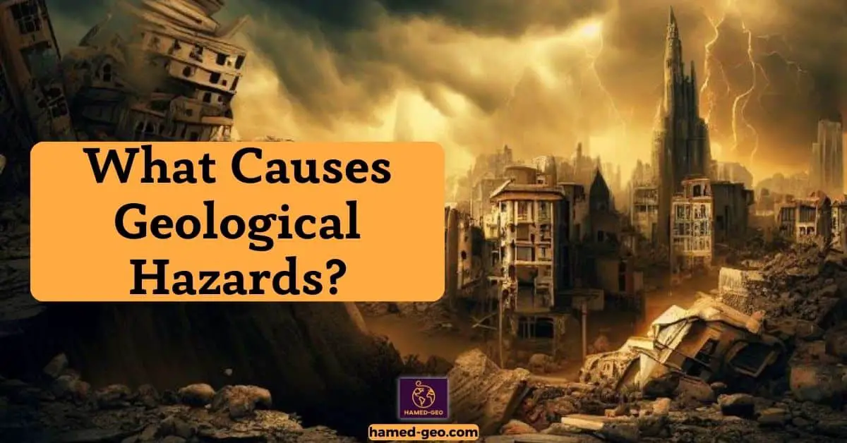
Geological hazards, such as earthquakes, volcanic eruptions, and landslides, pose significant threats to life, property, and the environment, and their impacts are exacerbated in densely populated regions. These hazards, collectively termed geohazards, have been responsible for millions of casualties and billions of dollars in economic damages worldwide. For instance, in 2010, the earthquake in Haiti resulted in over 230,000 deaths and an economic loss of approximately $8 billion, equating to nearly 120% of the country’s Gross Domestic Product.
Mitigation strategies are crucial to minimize the devastating effects of these natural disasters. The field of geological hazard mitigation focuses on understanding the mechanisms of these geohazards, assessing their potential impacts, and designing effective strategies to reduce their risks. This includes developing early warning systems, land-use planning, and engineering solutions, such as constructing earthquake-resistant buildings. Importantly, the success of these mitigation strategies depends largely on the incorporation of scientific knowledge into policymaking and the active participation of communities at risk.
Monitor Geological Conditions
Monitoring geological conditions necessitates a multi-faceted approach. Primary among these is the task of collecting and analyzing data, which involves the systematic gathering and interpretation of geological information. This aids in the development of early warning systems, designed to alert of impending geological events, thereby increasing preparedness and response. Moreover, the initiation of monitoring networks allows for continuous observation and understanding of geological phenomena. These networks, often an amalgamation of technology and expertise, serve as critical tools in a holistic approach to monitoring geological conditions.
Collecting and Analyzing Data
Indeed, mitigation strategies are crucial, but let’s not forget that constant monitoring of geological conditions forms the backbone of any successful mitigation effort.
Specifically, the collection and analysis of geological data are of paramount importance. The process involves gathering various types of data, including seismic activity, ground deformation, gas emissions, and hydrological changes. Notably, this data collection is often facilitated by advanced geotechnical instruments and remote sensing technologies.
The data, subsequently, are subjected to rigorous analysis using statistical and geospatial techniques. This analysis assists in identifying anomalies and patterns, which could potentially signal the onset of a geological event. The utilization of Machine Learning and Artificial Intelligence in data analysis has significantly enhanced the accuracy and speed of prediction.
By meticulously collecting and analyzing data, it becomes possible to detect subtle changes in the geological environment. This, in turn, aids in the early identification of potential geological risks, thereby enhancing the effectiveness of the mitigation measures.
Developing Early Warning Systems

Imagine the countless lives that could be saved with timely alerts of impending geological hazards.
This brings to the forefront the need for geoscientific research in the development of early warning systems. These systems provide crucial information, allowing enough time for evacuation or other necessary actions, thereby reducing the risk of casualties.
Studies indicate that the development of seismic early warning systems has been instrumental in saving lives during earthquakes. For instance, Japan’s earthquake early warning system has been a game-changer, providing valuable seconds for people to take cover before the quake hits.
Moreover, a comprehensive early warning system includes not just earthquake detection but also monitoring of volcanic activity, landslides, and tsunamis. This is achievable through the integration of real-time monitoring, data analysis, and rapid dissemination of alerts.
Remember, an effective early warning system is not a luxury, but a necessity in today’s geologically volatile world.
Establishing Monitoring Networks
The significance of establishing monitoring networks comes into play. With the advent of technology, the formation of these networks has become an instrumental part of monitoring and predicting geological events. These networks serve as the bedrock of data collection, analysis, and interpretation.
Installation of seismic stations, GPS networks, and satellite imagery systems form an integral part of these networks. Seismic stations aid in detecting and recording seismic activities, while GPS networks offer accurate data on ground deformation. Satellite imagery systems provide real-time images of the Earth’s surface, which are critical in identifying potential areas of geological hazards.
In essence, the establishment of a robust monitoring network enhances the efficiency and efficacy of hazard mitigation strategies by ensuring timely and accurate data collection.
Risk Assessment and Mapping
In assessing and mapping risks, the initial step encompasses analyzing the risk of geological hazards. This involves studying past and present data on geological events, such as earthquakes and volcanic eruptions, to predict potential threats. Subsequently, the creation of risk maps provides a visual representation of these potential hazards. Such maps can highlight the severity and probability of the risks involved. Further, it is imperative to pinpoint areas of high risk. This process involves identifying regions more susceptible to geological hazards, aiding in the development of effective mitigation strategies.
Analyzing the Risk of Geological Hazards
Moving forward from monitoring geological conditions, it is crucial to delve deeper into the realm of analyzing the risk of geological hazards. The analysis of geological hazards involves a systematic evaluation of the potential harm or loss that could occur due to geological phenomena such as earthquakes, landslides, or volcanic eruptions.
The first step in this process is the identification and characterization of hazards, which entails understanding their characteristics, frequency, magnitude, and spatial distribution. Remember, this understanding is critical because it directly influences the accuracy of risk assessment.
The next phase involves the assessment of vulnerability which, in turn, necessitates detailed knowledge about the elements at risk, including their location, value, and susceptibility to damage.
The final stage, the determination of risk, requires the integration of hazard and vulnerability information. In essence, risk equals hazard times vulnerability, a simple equation with profound implications for the safety and security of communities worldwide.
Creating Risk Maps
Building upon the understanding of geological conditions, the next step is to create risk maps. These maps represent a critical tool in disaster management. Risk maps are visual representations of potential hazards within a specific geographical area. These maps combine the data gathered about the geology of an area with information about potential hazards.
In the creation of such maps, data from various sources are compiled, including geological surveys, satellite imagery, and historical hazard data. The collected data is then analyzed using Geographic Information System (GIS) technology. This technology allows for the integration, analysis, and visualization of geological data in a map format.
The final product is a risk map that conveys the probability of certain geological hazards occurring in a specific area, such as landslides, earthquakes, or volcanic activity. The creation of these maps is an essential step in risk assessment, informing decision-making processes regarding safety measures and disaster response planning.
Identifying Areas of High Risk
Transitioning from the necessity of monitoring geological conditions, the gaze now turns to the crucial task of Identifying Areas of High Risk. Understanding the geographical realities of a region is integral to pinpointing those areas most susceptible to geological hazards.
Employing a comprehensive approach that combines satellite imagery, geological survey data, and historical hazard records can enable accurate identification of these sensitive zones. In the context of seismic risks, for instance, regions situated at the juncture of active tectonic plates are often subject to increased risk. Similarly, areas with a high incidence of landslides can be identified by analyzing soil composition, gradient, and vegetation cover.
To further refine this identification process, Ground Penetrating Radar (GPR) and Electrical Resistivity Tomography (ERT) can be utilized to detect subsurface anomalies. These technologies provide valuable insights into the geological conditions beneath the surface, thereby boosting the efficiency of risk identification.
Early Warning Systems
The development of an Early Warning System (EWS) is crucial in mitigating the impact of natural disasters. It involves three key stages: developing the system, monitoring geological hazards, and disseminating alerts and warnings. The initial stage consists of designing a reliable and efficient system capable of detecting potential risks. Then, continuous monitoring of geological activities is required, employing sophisticated technology and techniques. Lastly, the crucial phase of disseminating timely and accurate information to the public ensures immediate and appropriate response to emergencies. Proper execution of these stages can significantly reduce the devastating effects of natural calamities.
Developing an Early Warning System
Drawing a logical inference from the importance of risk assessment and mapping, let’s move to the next crucial step of hazard management: Developing an Early Warning System.
This process forms a critical component of disaster risk reduction, aiming to prevent loss and safeguard lives from imminent natural hazards. An effective early warning system incorporates four key elements: risk knowledge, monitoring and warning service, dissemination and communication, and response capability.
But why is this relevant?
Consider this: Development of such a system requires a deep understanding of the risks involved, thorough knowledge of the hazard, and careful planning. The creation of a robust early warning system is not just about technology; it involves an intricate interplay of scientific research, data collection, risk analysis, and operational logistics.
Ultimately, the goal is to ensure accurate, timely, and understandable warnings that can be disseminated to populations at risk. This paves the way for a prepared and proactive approach to impending hazards.
Monitoring Geological Hazards
In a world where the earth beneath our feet can suddenly become a source of devastation, monitoring geological hazards becomes a key element of any early warning system. Accurate and timely monitoring can make the difference between life and death in areas prone to earthquakes, volcanic activity, landslides, and other geological hazards.
At the heart of this process lies the utilization of state-of-the-art technology. Satellites, seismic networks, and remote sensing technologies are used to detect and track geological anomalies. Geographical Information Systems (GIS) allow for real-time mapping and modeling of hazard-prone areas.
Moreover, continuous research and development efforts are geared toward improving monitoring systems. For instance, the implementation of machine learning algorithms has shown promise in predicting geological events with increased accuracy.
Disseminating Alerts and Warnings
Building upon risk assessment and mapping, the final cog in the wheel of effective disaster management is the dissemination of alerts and warnings. This step ensures that pertinent information reaches the populace in a timely manner, thus enabling prompt action.
In the dissemination process, the use of diverse communication channels is crucial. These channels may include traditional media outlets, social media, mobile applications, and public address systems. The United Nations Office for Disaster Risk Reduction asserts that the use of multiple channels increases the likelihood of warnings reaching the widest possible audience.
In addition, the content of warnings should be clear, concise, and easily understandable. This includes using plain language and visual aids where necessary. The U.S. National Weather Service, for instance, employs color-coded maps to visually convey the severity and location of impending weather events.
In essence, the efficacy of an early warning system is largely determined by the effectiveness of its alerts and warnings dissemination process.
Disaster Preparedness
The fundamental elements of Disaster Preparedness encompass the formation of a comprehensive Emergency Plan, the establishment of a practical Evacuation Plan, and the strategic storage of Emergency Supplies. In creating an emergency plan, attention is drawn to the identification of potential risks and detailed response strategies. When establishing an evacuation plan, the focus is on safe escape routes and meeting points. Meanwhile, storing emergency supplies involves the careful selection and storage of essentials, including food, water, and medical necessities, to support survival during and after a disaster.
Creating an Emergency Plan
Moving from the early warning systems, imagine a scenario where disaster strikes and a warning is issued. The real test then becomes the efficiency of the emergency plan.
Any robust emergency plan should essentially have three main components: communication, safety actions, and meeting points.
Firstly, Communication. This is critical to ensure that all relevant parties are aware of the situation. It is particularly important to designate a point person for communication and provide clear instructions on what to do in the event of a disaster.
Next, Safety actions. This includes understanding and executing all necessary actions to ensure personal safety and the safety of others during a disaster.
Finally, Meeting points. It is crucial to identify and communicate safe locations where members can gather after a disaster.
In essence, creating an emergency plan is a comprehensive task that requires meticulous planning and effective communication. It is imperative to have a plan in place and ensure all members are aware of it.
Establishing an Evacuation Plan
While early warning systems provide a vital first line of defense, what happens next is equally crucial. And that’s where Establishing an Evacuation Plan comes in.
An efficient evacuation plan is a fundamental component of disaster preparedness. Studies indicate that well-rehearsed evacuation plans can significantly reduce loss of life during disasters. The plan should be clear, concise, and accessible to everyone. Remember, disaster situations are usually chaotic and stressful, thus necessitating a straightforward plan.
Key aspects of an evacuation plan include identifying safe areas within the vicinity, mapping out exit routes, and determining meeting points post-evacuation. Furthermore, the plan should detail the evacuation of vulnerable groups such as children, the elderly, and individuals with disabilities.
Successful disaster management is a multifaceted process, with the establishment of a well-thought-out evacuation plan being an essential aspect. Regular practice and revision of this plan can dramatically improve its effectiveness during a real disaster.
Storing Emergency Supplies
As the chilling reality of a disaster’s potential aftermath settles in, attention must be turned towards Storing Emergency Supplies. It is an integral part of disaster preparedness. It is estimated that in the immediate post-disaster period, individuals may be left without access to basic services and supplies for up to 72 hours. Therefore, storing a robust supply of essential items becomes paramount.
These supplies should include items such as food, water, medical supplies, and essential documents. Care should be taken to ensure that the stored food is non-perishable and requires minimal preparation. Also, a minimum of one gallon of water per person per day should be stored. Furthermore, a basic first aid kit, along with any essential medications, should be included in the emergency supplies. Lastly, copies of vital documents such as identification, insurance policies, and medical records should be safely secured.
Storing Emergency Supplies not only ensures survival during disaster periods but also offers reassurance during uncertain times.
Structural Mitigation Measures
In the pursuit of Structural Mitigation Measures, the architecture and construction industries employ complex strategies. One of these is Building Earthquake-Resistant Structures, which involves the use of flexible materials and smart designs to withstand seismic activities. Additionally, Constructing Flood-Proof Structures is paramount in areas prone to heavy rains and floods. Techniques such as elevation and the use of water-resistant materials are common. Finally, the focus on Designing Landslide-Resistant Structures is essential in hilly or mountainous areas, with strategies including reinforcing the ground and using retaining walls.
Building Earthquake-Resistant Structures
Shifting from the general concept of disaster preparedness, let’s delve into the specifics of structural mitigation measures. Primarily, the focus will be on Building Earthquake-Resistant Structures.
In earthquake-prone regions, constructing structures capable of withstanding seismic activities is a critical aspect of disaster risk reduction. To achieve this, the incorporation of seismic design principles is paramount. These principles entail using ductile materials capable of undergoing deformation without breaking, such as steel and reinforced concrete. Additionally, the regular shape and symmetrical layout of structures contribute to increased stability during earthquakes.
Furthermore, the application of base isolation techniques – where the building is separated from the ground on flexible bearings – has proven effective in reducing the impact of ground movement on the structure. It was reported in a study published by the Earthquake Engineering Research Institute, that the Christchurch Women’s Hospital in New Zealand, built using base isolation techniques, remained operational throughout the 2011 earthquake.
Constructing Flood-Proof Structures
Shifting from the broad concept of disaster preparedness, let’s delve into the tangible and practical application of this knowledge, focusing particularly on constructing flood-proof structures. Floods, which are among the most frequent and costly natural disasters, require specific planning and construction methods to mitigate their destructive power.
A common and effective approach is the construction of raised structures. By elevating a building above the local base flood level, the risk of floodwater intrusion can be significantly reduced. This technique is widely used in flood-prone regions, such as the Mekong Delta in Vietnam, where homes are often built on stilts.
Another crucial factor in flood-proof design is the use of water-resistant materials, which can endure the adverse effects of water exposure. Such materials include marine plywood, stainless steel, and specially treated bricks.
Lastly, the implementation of floodwalls and levees around the structure can serve as an additional barrier against floodwater.
Designing Landslide-Resistant Structures

Moving along to another critical aspect of structural mitigation measures, one can’t overlook the significance of designing landslide-resistant structures. Given the increasing cases of landslides, particularly in hilly or mountainous regions, it becomes essential to incorporate landslide resistance in urban planning and construction.
An effective measure includes the use of retaining walls to resist the force of the landslide. These walls, when constructed with proper materials and techniques, can substantially reduce the risk. Furthermore, proper drainage systems help in minimizing waterlogging, a common cause of landslides.
Incorporate slope stabilization techniques such as soil nailing and ground anchors, which fortify the ground and prevent soil displacement. Additionally, structural design must align with the geological and topographical features of the area.
These measures, when implemented effectively, can significantly mitigate the risk of landslides, ensuring the safety and longevity of the structures, and by extension, the communities residing within them.
Non-Structural Mitigation Measures
Non-structural mitigation measures encompass three key areas namely, developing hazard-resistant land use plans, establishing risk reduction policies, and implementing risk reduction strategies. First, hazard-resistant land use plans necessitate the integration of risk assessment into urban planning. Subsequently, the formulation of risk reduction policies aims to facilitate proactive measures, rather than reactive responses, towards potential disasters. Lastly, the successful implementation of these strategies requires continuous evaluation and refinement, ensuring the robustness of these measures against the dynamic nature of disaster risks.
Developing Hazard-Resistant Land Use Plans
While structural mitigation measures are a critical component of disaster risk management, it’s time to turn the spotlight on non-structural mitigation measures. A significant part of these measures is the development of hazard-resistant land use plans.
Such planning strategies take into account potential hazards and the vulnerability of the area in question. By doing so, the possibility of damages can be significantly reduced. A key aspect of this strategy is the identification of the hazard zones. For instance, flood-prone areas can be delineated using historical flood data and geographical information system (GIS) tools.
Once these zones are identified, land use regulations can be formulated to guide the development of infrastructure in these areas. In the case of flood-prone areas, for example, construction of critical infrastructure might be prohibited.
Moreover, these plans are typically developed with the involvement of a wide range of stakeholders, including planners, engineers, and community members. This collaborative approach ensures the plan is comprehensive and practical.
Establishing Risk Reduction Policies
Transitioning from the architectural aspect of mitigation, attention now turns to the policy frameworks that support these measures. In the realm of Non-Structural Mitigation Measures, establishing risk reduction policies forms a crucial component.
Policies that reduce risk serve as the backbone of any comprehensive mitigation strategy. The creation and implementation of these policies necessitate collaborative efforts among various stakeholders, including government agencies, community organizations, and private sector entities. By working together, these entities can develop policies tailored to the specific risks faced by their community.
For instance, a coastal city might establish a policy restricting construction in areas prone to flooding, thus reducing potential damages. Similarly, a policy might require the use of fire-resistant materials in areas prone to wildfires.
These policies, while seemingly restrictive, are essential in safeguarding communities and reducing the toll of natural disasters. Therefore, the establishment of risk reduction policies forms an integral part of non-structural mitigation measures.
Implementing Risk Reduction Strategies
Moving away from the tangible aspects of structural mitigation measures, a deeper dive into non-structural mitigation measures unveils a plethora of strategies that primarily revolve around planning, policy-making, and implementation. Focusing on the implementation of risk reduction strategies, these approaches are designed to limit the adverse impacts of hazards on communities.
Implementing risk reduction strategies involves the application of scientific knowledge, technological tools, proactive rules, and regulations. For instance, the use of Geographical Information System (GIS) technology has proven instrumental in identifying hazard-prone areas and planning for risk reduction. In addition, the enforcement of stringent building codes and zoning regulations can significantly reduce vulnerability to hazards.
Furthermore, public awareness campaigns play a crucial role in risk reduction strategy implementation. These initiatives serve as a platform for disseminating valuable information about potential hazards and encouraging communities to take preventative measures.
Implementing risk reduction strategies forms an integral part of non-structural mitigation measures, orchestrating a symphony of harmonious actions that collectively aim to safeguard communities from the devastating impacts of hazards.
Education and Awareness
In the realm of Education and Awareness, the significance of Educating the Public About Geological Hazards is paramount. This involves providing accurate information about the risks and potential impacts of such hazards. Subsequently, the development of effective Risk Communication Strategies is essential, which enables the transmission of vital safety information. Additionally, Promoting Risk Mitigation Measures – such as retrofitting buildings and strategic land-use planning – is a crucial step in reducing vulnerability to geological hazards. These subtopics collectively contribute to a more informed and prepared society in the face of geological threats.
Educating the Public About Geological Hazards
Now, let’s shift gears and delve into a key aspect of non-structural mitigation: educating the public about geological hazards. With the increasing frequency of natural disasters, raising public awareness about geological hazards is of the utmost importance. By imparting knowledge through various mediums such as public workshops, online courses, and educational programs, society can be better equipped to handle such dangers.
A study conducted by the International Journal of Disaster Risk Reduction affirmed that individuals who were educated about geological hazards were significantly more likely to take protective measures during such events. Moreover, this education fosters a culture of preparedness and resilience, thereby reducing the risk of devastation caused by geological hazards.
In essence, accurate and comprehensive education about geological hazards is not merely an add-on, but a critical facet of disaster risk reduction strategies. It’s a powerful tool that holds the potential to save countless lives and properties.
Creating Risk Communication Strategies
Having considered non-structural mitigation measures, let’s delve into a pivotal aspect of disaster management: Creating Risk Communication Strategies. Efficient communication plays an instrumental role in managing geological hazards. It provides a bridge between knowledge about hazards and actions to mitigate risk.
An effective risk communication strategy includes transparent information dissemination, where all relevant information about a hazard is openly provided. This allows the public to make informed decisions about personal safety measures. Moreover, it is crucial to ensure that the information is accessible, understandable, and actionable. Utilizing social media, emergency broadcasts, and public service announcements can aid in reaching a larger audience.
In addition, collaboration between scientists, policy-makers, and the public is essential for a useful risk communication strategy. Regular workshops and public hearings can foster this interaction, leading to enhanced understanding and preparedness. The ultimate goal is to create a culture of safety and resilience within communities.
Promoting Risk Mitigation Measures
Imagine this scenario: countless lives saved, properties preserved, and communities thriving despite the omnipresent threat of geological hazards. This can be achieved through the systematic promotion of risk mitigation measures.
As a crucial part of risk management, enhancing public understanding and acceptance of these measures paves the way for safer, more resilient societies. The spotlight falls on the necessity of implying preventive strategies such as land-use planning, building codes, and insurance policies.
For instance, a study by the American Planning Association in 2014 highlighted that communities that adapted their land-use policies to account for geological risks significantly reduced the damage caused by such hazards. Similarly, the National Institute of Building Sciences found that every dollar invested in mitigation measures saves society six dollars in post-disaster recovery.
To sum up, promoting risk mitigation measures, not only bolsters societal resilience but also makes economic sense, creating a win-win situation for all stakeholders involved.
The Future of Geological Hazards Mitigation
Emerging technologies are playing a significant role in the future of geological hazard mitigation. These advancements, particularly in the realm of Artificial Intelligence (AI), provide innovative solutions for predicting and managing natural calamities. AI uses complex algorithms to analyze geological data, aiding in more accurate hazard forecasts. Simultaneously, a critical focus lies on developing sustainable solutions. These eco-friendly methods aim to minimize the environmental impact while effectively mitigating geological hazards, thus paving the way for a safer and greener future.
Emerging Technologies
Emerging technologies are pioneering tools and methodologies that offer a transformative approach, reshaping the landscape of hazard management.
For instance, Remote Sensing Technologies have the potential to revolutionize geological hazard detection and monitoring, providing spatial and temporal data that can inform predictive models and early warning systems. Likewise, the advent of Unmanned Aerial Vehicles (UAVs), commonly known as drones, has opened up new possibilities for real-time monitoring and rapid response, particularly in inaccessible or hazardous areas.
Moreover, Geographic Information Systems (GIS) and Global Positioning System (GPS) technologies have become instrumental in mapping and analyzing geological hazards, improving our understanding of risk areas, and enhancing decision-making processes. These emerging technologies, thus, hold the promise of a more resilient future, capable of mitigating the devastating impacts of geological hazards.
The Role of Artificial Intelligence

Delving into a futuristic realm, Artificial Intelligence (AI) holds significant potential in mitigating geological hazards. AI platforms, through machine learning and predictive modeling, can enhance the accuracy of hazard prediction and risk analysis. For instance, Deep Learning algorithms can analyze vast and complex geological data sets, predict potential hazards, and provide early warnings. Such AI applications can potentially reduce the devastating impacts of geological threats such as earthquakes, landslides, or volcanic eruptions.
Moreover, AI can aid in developing new geological hazard mitigation strategies by identifying patterns and trends in historical data. For instance, Reinforcement Learning can optimize evacuation routes during a disaster, hence saving lives.
In essence, the integration of AI into geological hazard management not only promises an improved prediction accuracy but also a proactive approach towards disaster mitigation. Undeniably, the transformative role of AI is shaping the future of geological hazard mitigation, thus paving the way for a safer and more resilient world.
Developing Sustainable Solutions
Developing sustainable solutions stands out as a key strategy in the fight against these natural disasters.
The development of sustainable solutions in mitigating geological hazards encompasses a range of activities. It includes the implementation of innovative, environmentally friendly technologies, and the application of best practices in disaster risk management. Central to this approach is the understanding that sustainable solutions should not only solve the immediate problem but also consider long-term implications to ensure that future generations are not compromised.
In practice, this could mean prioritizing solutions that reduce the vulnerability of communities and infrastructure, promote biodiversity and healthy ecosystems, and facilitate sustainable development. For instance, in areas vulnerable to landslides, sustainable solutions might include the use of bio-engineered slopes, which not only stabilize slopes but also promote biodiversity.
The future of geological hazard mitigation is undeniably intertwined with the adoption of sustainable solutions, marking a paradigm shift in disaster risk reduction.
In conclusion, mitigation of geological hazards is a multi-faceted approach, requiring both foresight and cooperation on various levels. The success of such efforts lies in the integration of risk assessment, monitoring, preparedness, and both structural and non-structural measures.
The future of geological hazard mitigation hinges on the balance of resources, education, and international cooperation. Through informed decision-making and improved coordination, the impact of these hazards can be significantly reduced. The importance of geological hazard mitigation cannot be overstated.