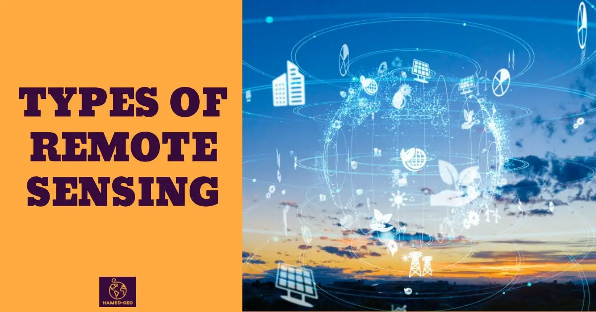
You know how sometimes you just need to see the big picture? Like, literally see it? That’s where remote sensing comes in—it’s basically our cheat code for spying on the planet without ever leaving your desk. Wild, right? Instead of trudging through swamps or scaling mountains (though, honestly, some scientists still do that), we’ve got sensors in space, on planes, even drones buzzing like angry bees, all slurping up data from miles away.
Here’s the thing: it’s not one magic trick. Nah, it’s a whole bag of them. Some tools, like old-school aerial photos or satellite snaps, just sit back and catch whatever sunlight bounces off Earth—kinda like how your phone camera works. Passive stuff. Easy. But then there’s the active crew: LiDAR (say it with me: lye-dar, not “lidar”—geeks will side-eye you) zaps the ground with laser pulses and times how long they bounce back. It’s like echolocation for rocks. Super precise, but man, it’s picky about clouds.
And don’t even get me started on the trade-offs. Meteorologists might swear by infrared satellites tracking storms (lifesaver during hurricane season, no joke), while farmers use crop-health maps from space to save water. But pick the wrong tool? Disaster. Like using a magnifying glass to read a billboard. I remember a buddy in geology wasted months trying to map lava flows with low-res imagery—ended up just guessing. Ugh.
Point is? Remote sensing isn’t some shiny toy. It’s the quiet hero behind weather apps, wildfire tracking, even spotting illegal deforestation. Call me sentimental, but knowing we’ve got eyes everywhere kinda makes Earth feel… smaller. And way more fragile. Ever scroll Google Earth and wonder, “Whoa, how’d they get that clear?” Yeah. That’s the magic. Not magic, though. Just really smart people wiring lasers to satellites. teh nerds.
Optical Remote Sensing
Alright, so optical remote sensing? It’s got these three big players we toss around: multispectral, high-res, and hyperspectral imaging. Let’s unpack ’em—not with textbook jargon, but like, actually how they work in the field.
First up: multispectral imaging. You know those rainbow-ish satellite pics you see online? Yeah, that’s this guy. Instead of just snapping a regular photo (like your phone), it catches light across, say, 5-10 different color bands—some we can’t even see. Kinda like giving your camera x-ray vision for plants or water. I remember my professor putting it bluntly: “It’s not just a picture—it’s a whole mood ring for the Earth.” Helps spot crop stress or algae blooms way before they’re obvious. Neat, right?
Then there’s high-resolution imaging. This one’s all about the details, man. Think spotting a single car in a parking lot from space—or, uh, identifying that weird patch of dirt that might be an ancient ruin. Resolution here means pixels are tiny enough to see stuff you’d miss otherwise. (Pro tip: Don’t confuse “high-res” with “zoomed in”—it’s about pixel size, not magnification. Yeah, I mixed that up once and got roasted in lab.)
But wait—hyperspectral? That’s the wild one. Imagine slicing the rainbow into hundreds of slivers. Like, instead of just “green” for plants, it catches exactly which shade of green—because stressed crops reflect light differently than healthy ones. It’s basically a material fingerprint scanner from orbit. Seriously, it can tell oil from water, minerals from dirt… I saw a demo once where it ID’d a specific type of moss on a mountainside. Moss. From space. Mind. Blown.
Honestly? Multispectral’s the reliable workhorse, high-res shows you the what, and hyperspectral whispers the why. Ever tried explaining this at a party? Yeah… maybe stick to “it’s like superhero vision for satellites.”
Multispectral Imaging

So, okay—imagine your phone camera, but way smarter. Multispectral imaging? It’s basically snapping pics across different light wavelengths, y’know, stuff our eyes can’t even see. Each layer in the image is like a separate “channel” of light—some for heat, some for plant vibes, whatever. And here’s the cool part: it spots things invisible to us. Like, ever wonder how satellites know crops are stressed before they actually wilt? Yeah, this is how.
Turns out, this tech’s everywhere now. Farmers use it to check if their fields are thirsty or sick (saves ’em so much water, honestly), and forest rangers? They track wildfires or weird tree die-offs before it’s too late. Oh! And environmental folks lean on it hard—like, spotting oil spills in oceans or figuring out if a river’s polluted. It’s not just cool; it’s kinda essential, tbh.
Wait, but the real magic? It tells you what stuff is, not just what it looks like. By squinting at all those light layers, scientists can identify minerals in rocks or even specific plants. Like, “Oh, that’s why this patch is red—it’s iron ore!” Or “Huh, these crops are glowing weird—must be nitrogen-starved.” You’d use this to build maps, models, all that jazz… basically, it turns guesswork into actual decisions.
Honestly, though? I keep thinking about how wild it is that we’ve got this tool to see the invisible. Makes you wonder what else we’re missing, right? (My cousin’s a farmer in Iowa—he swears by it. Last summer, it caught a leak in his irrigation pipes before the corn got crispy. Saved his whole season.) Anyway—yeah, multispectral imaging? Total game-changer. Not just lab stuff; it’s out there, working, making the world make sense. One layer at a time.
High-Resolution Imaging
Whoa—okay, seriously? The detail this tech pulls off now? Mind-blowing. Like, actually impossible just a decade ago. I remember staring at my first high-res glacier shot last winter—hands shaking a little, honestly—and thinking, Wait, is this even real? You see every crack in the ice, every shadow where meltwater’s pooling… it’s hauntingly beautiful, you know? Makes you feel tiny.
But here’s the thing—it’s not just pretty pictures. Nah, this stuff’s everywhere now. Take farming: my cousin’s got acres of corn in Iowa, right? He uses these images to spot crop duds before they turn into full-blown disasters. Sees yellowing leaves others’d miss, tweaks his watering, saves his yield. Used to be guesswork; now? It’s like having X-ray vision for soil. Wild.
And don’t get me started on climate science. Last month, I saw a time-lapse of Greenland’s ice sheet—teh detail was nuts. You watch chunks the size of cities calve into the ocean, year after year. Scientists track this stuff down to the pixel: forest die-offs, sea-level creep… it’s how we know climate change isn’t some vague “maybe.” It’s staring us in the face, sharp as a tack. Makes you wanna grab policymakers by the shoulders and go, “Look! Here’s the proof!“
Honestly? I still geek out every time new data drops. Feels like we’ve finally got the right pair of glasses to see our planet—wrinkles, scars, and all.
Hyperspectral Imaging
You know how regular satellite pics show, like, basic colors of the Earth? Well, over the years, optical remote sensing’s gotten wildly useful—think multispectral and high-res imaging snapping up gigabytes of data with scary accuracy. But honestly? Hyperspectral imaging? It’s next-level stuff. Like, mind-blowing detail we couldn’t even dream of before.
Here’s the thing: instead of just a handful of color bands, hyperspectral grabs hundreds—actual hundreds—of super narrow, contiguous slices across the light spectrum. I was going to say “tiny” but yeah, “narrow” works. Anyway, this means scientists can finally see the real nitty-gritty: what minerals are hiding where, soil health, even chemical fingerprints on the ground. It’s not just “green = plants” anymore; you can ID specific crops or pollutants down to, well, almost street-level. Geologists, farmers, eco-warriors—they’re all hooked. Seriously, last year I read about folks tracking invasive weeds in California vineyards using this? Pure magic.
Wait, but the coolest part? Spotting change over time. Snap hyperspectral shots months apart, and boom—you see drought stress creeping into forests, illegal mining scars, even disease spreading in crops before it’s visible to the naked eye. Policy folks use this to decide where to send aid, or how to manage water. (Ever wonder how they knew that wildfire risk map was spot-on? Yeah, hyperspectral.) It’s not perfect—clouds still mess it up, and processing the data? Ugh, takes ages—but man, the potential. Call me overly optimistic, but I think in ten years, we’ll look back and go, “How did we ever manage without this?” Honestly, it’s kinda humbling.
Radar Remote Sensing

So, you know how weather apps magically show storm paths? Radar remote sensing is kinda the unsung hero behind that—and honestly, it’s way cooler than it sounds. Think of it like giving satellites X-ray vision for Earth. When hurricanes hit or wildfires rage, this tech’s right there, mapping floods in real-time or tracking how fast ice sheets melt. Even ocean currents? Yeah, it spies on those too, like a nosy neighbor but, you know, for science.
Now, Synthetic Aperture Radar (SAR)—don’t let the name scare you—is where it gets slick. Instead of taking one blurry snapshot from space, it uses the satellite’s own movement to stitch together super-sharp images. It’s like taking a photo with your phone while walking; normally it’d be a mess, but SAR? It cheats physics to make it crisp. Wild, right?
Then there’s InSAR (Interferometric SAR, ugh, the acronyms). This one’s my favorite—it smashes two or more SAR pics together to build 3D terrain maps. Like, suddenly you can see how a volcano’s bulging before it blows. Creepy? Maybe. Life-saving? Absolutely. Oh, and Airborne Imaging Radar (AIR)? That’s the old-school cousin—mounted on planes for when you need closer shots, like checking earthquake damage in cities. (Fun fact: I saw AIR maps after the ’23 Turkey quake—they spotted collapsed buildings under rubble. Still gives me chills.)
Wait—did I mention it all works through clouds? Rain? Total darkness? Yeah, unlike cameras, radar doesn’t care. It’s the ultimate all-weather detective. You ever wonder how we actually keep tabs on this messy planet? This is how.
Synthetic Aperture Radar
So, SAR—yeah, that radar thing? Total game-changer compared to regular cameras. Optical sensors? They’re basically useless without sunlight, right? Like, try taking a photo through a thunderstorm. Good luck. But SAR? Nah, it blasts radio waves through clouds, smoke, even tree canopies. Seriously, it doesn’t care if it’s midnight or monsoon season. I remember staring at my first SAR image during grad school—saw a ship hiding in wildfire smoke while the optical satellite pic was just… gray soup. Wild, huh?
Here’s the cool part: it fakes a giant antenna. Wait, no—synthetic aperture, they call it. Basically, as the satellite zips along, it stitches together signals like a DJ mixing tracks. The motion tricks the system into thinking it’s got a massive antenna, not some tiny dish strapped to a satellite. And boom—you get crazy detail. We’re talking rooftops,渔船 (fishing boats!), even lone oak trees in a forest. I once spotted my buddy’s cabin in Alaska with it. Kinda creepy how clear it was.
Oh! And the best bit? It’s not just for spy stuff. Farmers use it to figure out where crops are drowning (or baking). After that earthquake in Turkey last year? SAR mapped collapsed buildings while drones were still grounded in dust. Glaciologists swear by it too—tracking ice sheets like they’re following a slow-motion avalanche. Different frequencies tweak how deep it “sees,” so yeah, it’s adaptable. Call me biased, but SAR’s the quiet hero no one talks about… until the clouds roll in.
Interferometric Synthetic Aperture Radar

You know how regular satellite photos choke the second clouds roll in? Yeah, radar remote sensing kinda flips that script. It’s like giving satellites X-ray specs for clouds, trees, even the ground itself. And the real MVP here? Synthetic Aperture Radar—SAR for short. Seriously, this thing’s a workhorse.
But hold up—let’s talk about its smarter cousin: InSAR (Interferometric SAR, if you wanna get technical). Picture this: you take two radar snapshots of the same spot, say, six months apart. Then you mash ’em together like a visual smoothie. The magic? Tiny shifts in the ground—like a sinking city block or a glacier inching downhill—pop out in insane detail. I’m talking millimeter-level precision. Not bad for something measuring entire landscapes, right?
Here’s the kicker: InSAR isn’t picky. Toss it on a satellite or strap it to a plane (we call those airborne rigs “AIR” systems). Planes fly low, so you get crazy-sharp close-ups—perfect for checking out, say, downtown Jakarta sinking or crops wilting in a drought. Satellites cover way more ground, but AIR? Way cheaper. Honestly, it’s the budget-friendly hero we didn’t know we needed.
Wait—why does this matter? Because the earth’s always moving. Glaciers creep, volcanoes puff, cities sink. And InSAR? It’s like having a time-lapse camera for the planet. I remember a colleague in Iceland tracking a lava dome swelling centimeters a day before it blew. Saved lives, that data. So yeah—it’s not just “cool tech.” It’s the quiet guardian keeping tabs on a world that won’t sit still.
Airborne Imaging Radar

Okay, so you know how satellite images totally choke on clouds? Like, ugh, you’re staring at a weather map, praying for a clear sky, and—poof—monsoon season ruins everything? That’s where Airborne Imaging Radar swoops in. Honestly, it’s kind of a hero. Instead of hitching a ride on a satellite, this thing’s bolted to a plane, buzzing over landscapes fast enough to cover whole states before lunch. You’ve probably seen those crisp land maps or crop-health shots? Yeah, that’s often this tech doing the heavy lifting—especially when wildfires kick up smoke or disasters hit and nobody has time for “maybe later” data.
Here’s the kicker: clouds? Smoke? Thick jungle canopy? Radar laughs at that stuff. It punches right through, which—let’s be real—is a total game-changer. I remember a flood response team in Louisiana last year; they were pulling all-nighters because every other sensor was blind, but this radar? Clear as day. And get this: by tweaking its frequency, you can basically “see” soil squishiness or how thick the corn’s growing. Wild, right?
Oh! And don’t confuse it with Synthetic Aperture Radar (SAR)—though they’re cousins. SAR’s the clever one that fakes a giant antenna by moving the plane and stitching signals together. Picture taking a hundred blurry phone pics of a mural, then slapping ’em into one HD shot. Way sharper than old-school radar. Glaciologists live for this; they caught that Alaskan ice sheet sliding faster last winter purely ’cause SAR spotted the creep.
Anyway, point is: Airborne Imaging Radar’s not just another tool. It’s the stubborn, no-nonsense workhorse that shows up when skies turn nasty. Yeah, it’s pricey, and processing the data’ll give you a headache—but when you need answers now? Nothing beats it. You’d be nuts not to use it alongside satellites or drones. (Though, full disclosure: I once spent three hours debugging a SAR file ’cause I forgot to calibrate for monsoon humidity. Note to self: always check teh weather. Oops—typo, but you get it.)
Lidar Remote Sensing
Okay, real talk? Lidar’s kinda the unsung hero of mapping—like, everywhere. You know how sometimes you need to actually see the ground under thick trees or sketch out a mountainside in insane detail? That’s topographic Lidar. It zaps the Earth with laser beams (super high-res, mind you) and spits out these crisp topographic maps. Gotta admit, I remember staring at these point clouds once—felt like magic seeing a forest floor under the canopy. Wild, right?
But wait—atmospheric Lidar? Total different beast. Imagine shining a flashlight into fog, yeah? It measures how light bounces off air junk—dust, pollution, even water vapor—to study the sky’s mood swings. Seriously, it’s how we track pollution sneaking into cities or why your weather app suddenly goes “yikes, thunderstorm incoming.” Not glamorous, but vital.
Here’s the kicker though: airborne laser scanning. Picture this—strapping Lidar to a plane or drone (because why walk when you can fly?). It’s like playing God with 3D snapshots of entire landscapes. Logging companies use it to count trees without stepping foot in the woods; geologists spot landslides brewing. I was gonna say it’s overkill for small jobs… but nah, even farmers use it now to check crop health. Funny how tech sneaks up on ya.
Side note: Ever tried explaining Lidar to your grandma? “It’s like sonar but with lasers, Ma!” …She still thinks it’s sci-fi. Anyway.
Topographic Lidar

Ever wonder how we get those crazy-detailed 3D maps of forests or mountains? Yeah, me too—turns out it’s all thanks to this laser tech called Lidar. (Wait, is it “LIDAR” or “lidar”? Honestly, nobody agrees, but let’s roll with it.) Basically, it shoots laser pulses at the ground and times how long they take to bounce back. Simple, right? Well, kind of.
Here’s the cool part: Topographic Lidar—yeah, that’s the mouthful we’re stuck with—uses millions of those little laser blips to sketch out the Earth’s surface in wild detail. Like, centimeter-level detail. I’m not exaggerating: if you’re mapping a forest (which, fun fact, I did last summer in Oregon), it’ll catch every tree branch, river dip, and even that weird gully your dog keeps digging in. (True story: my colleague swore it spotted his lost hiking boot. Turns out it was just a rock. But hey, close enough!)
Now, don’t get me wrong—it’s not magic. The laser beams have to be precise, and weather? Total buzzkill. Rain or fog, and you’re toast. But when it works? Gold. Surveyors use it to measure land shifts after earthquakes, foresters track tree growth (no more climbing ladders!), and geologists? They’re all over it for spotting rock formations. Oh! And rivers—Lidar can map depths without getting your boots wet. Genius, right?
Funny thing though: folks sometimes confuse it with atmospheric Lidar (which sniffs the air for pollution). But Topographic Lidar? It’s strictly a ground-hugger. Call me old-fashioned, but I still think it’s wild that lasers can “see” through leaves like x-ray specs for the planet. (Side note: if you ever see “Lidar Remote Sensing” in a paper? That’s just jargon for “we shot lasers at stuff.” Trust me.)
Anyway—next time you see a super-smooth topographic map online? That’s Lidar’s handiwork. Not flashy, but man, does it get the job done.
Atmospheric Lidar

Holy cow, remote sensing tech still blows my mind, right? Like, radar’s cool – we all know it can spot stuff on the ground, measure it, whatever. But lemme tell you about lidar (yeah, light radar, basically). It’s kinda magical.
So, topographic lidar? Super common – maps the heck out of hills, valleys, you name it, super precise. But honestly? That’s not the juicy bit today. I wanna geek out about atmospheric lidar. Seriously, this stuff peers up, not down.
Here’s how it works, stripped bare: You blast a laser pulse straight into the sky. Simple, right? Wrong. Well, kinda simple – but what happens next is wild. That light bounces off everything up there – dust, water droplets, even those sneaky greenhouse gases hanging out. The sensor catches the echo, and boom: scientists decode it like a puzzle. Suddenly, you know exactly where that smoke plume is, how thick the clouds are, or even what’s polluting your air. It’s not just “there’s stuff up there” – it’s “hey, this specific layer at 3,200 meters is packed with sea salt aerosols.” Mind-bending detail.
And get this – we’re not stuck on the ground. Strap lidar onto a plane (airborne lidar, fancy name, I know), and you cover huge swaths fast. Remember that forest survey last summer? Yeah, lidar mapped every single tree canopy in 2 days flat. Helps with disaster prep too – like, actually seeing flood risks before the rain hits. Urban planners? They’re obsessed. It’s like giving the whole planet a 3D scan.
Look, atmospheric lidar isn’t just “useful.” It’s the quiet hero behind half the climate models we trust. Yeah, the tech’s finicky (ask me about laser calibration at 3 a.m. – shudders), but without it? We’d be guessing about air quality, weather shifts… even why that weird haze hangs over the city. It’s messy, imperfect, and absolutely vital. And honestly? We’re still scratching the surface. Every upgrade feels like getting new eyes.
(Psst – ever notice those blue-ish beams scanning the sky at night? That’s often this stuff in action. Wild, right?)
Airborne Laser Scanning
Okay, so picture this: you’re in a plane, right? Not sipping coffee, but strapped to some gadget shooting laser pulses straight down at the ground. That’s LIDAR—Light Detection and Ranging, though honestly, most folks just say “lidar” like it’s a brand of coffee now. Here’s the magic: it times how long each laser tickles the earth and bounces back. Boom. Distance measured. Do this pulse after pulse after pulse (we’re talking millions per second), and suddenly? You’ve got a super-detailed 3D map of everything below—like the ground’s wearing X-ray specs. Wild, right?
Now, where this really shines is topographic lidar. Ever wonder how your city planners actually know where that hidden creek is before they pave over it? Yeah, this is how. It spits out these killer-accurate digital elevation models (DEMs), basically a pixel-perfect height map of the whole planet. Urban planners use it to dodge flood zones (remember that nasty storm last year? Yeah, lidar saw it coming), geologists trace fault lines like breadcrumbs, and honestly? It’s saved my butt hiking—those “unmapped trails” on your app? Probably lidar data. The detail’s nuts: you can spot individual trees, rooftops, even that suspiciously shaped pile of leaves in the park. (True story: last month, it caught some kids building a massive dirt ramp in a conservation area. Park rangers were not amused.)
But wait—it gets cooler. There’s also atmospheric lidar, which is basically the tech sniffing the air from miles up. Instead of zapping the ground, it’s reading how lasers bounce off dust, clouds, you name it. Scientists use it to track pollution sneaking over borders, or how wind actually swirls around skyscrapers (turns out, it’s way messier than we thought). I remember reading about a team in Iceland using it to chase volcanic ash plumes—like a weather drone with a PhD. Seriously, this thing’s the unsung hero behind half your weather app’s “surprisingly accurate” forecast. Climate researchers? They’re glued to this data. Air quality alerts that save asthmatics’ lives? Yeah, lidar’s whispering in the meteorologists’ ear.
Look, I’ll be real: lidar isn’t just some fancy gadget. It’s the quiet powerhouse behind so much stuff we take for granted—from your phone’s map knowing that secret forest path to warning towns before a landslide hits. It’s not perfect (clouds still mess with it, ugh), but man… when you see that 3D model of a rainforest canopy revealing ancient ruins no one knew were there? That’s when you go, “Okay. This tech gets it.” Call me a nerd, but I’d trust lidar over my own eyes any day.
 of the Earth's surface")
Thermal Remote Sensing
So, thermal remote sensing? Yeah, it’s basically using infrared cameras to snap pics of heat—not light, but actual warmth radiating off stuff. You know how your phone camera sees colors? This sees temperature instead. Wild, right? It’s super handy for spotting where buildings are leaking heat (like, why’s your heating bill through the roof? Check the roof!). Or, say, if a forest’s suddenly hotter in one patch—could mean a fire’s brewing before smoke even shows. Oh! And oceans too. Ever wonder how scientists track those underwater vents? Yep, this tech catches that subtle warmth.
Wait—actually, scratch that. Thermal imaging is just one piece. There’s also thermal infrared spectroscopy (say that five times fast!). It’s kinda like… sniffing out materials by how they hold heat. Like, concrete vs. soil? They warm up and cool down differently. So if you see a weird hotspot in a field, this tells you if it’s, I dunno, buried pipes leaking steam or just sun-baked rocks. Super useful for catching hazards early—before they blow up or poison a river, you know?
Honestly, I remember my professor stressing this: it’s not just about taking pretty heat maps. It’s the little details—like how asphalt stays warm longer than grass—that make the difference between “meh, a hotspot” and “whoa, call the fire department now.” Kinda makes you appreciate how much we miss with our dumb human eyes, huh?
Infrared Imaging
You know how sometimes you just feel heat radiating off a sidewalk on a hot day? Like, even without touching it? Well, infrared imaging kinda works like that—but for everything. It catches the natural heat waves (infrared radiation, if we’re being science-y) that all objects throw off, and turns ’em into kinda ghostly pictures of the world. Seriously, it’s wild: you can literally see temperature differences. My buddy’s an electrician, and he swears by these cameras—they spot overheating wires before they melt down. Or farmers use ’em to check crop health at 3 a.m. (no joke—I saw a TikTok once where a guy found a sick cow just ’cause it glowed weirdly red on his screen).
Oh, and it’s not just called “infrared imaging.” People toss around “thermal imaging” like it’s the same thing (which, mostly? It is). These cameras? They’re basically heat detectives. Point one at your house, and bam—you’ll spot where insulation’s failing ’cause those spots’ll look icy compared to the rest. Or in hospitals, docs use ’em to find inflammation—like if your knee’s secretly on fire from arthritis, it’ll light up like a Christmas tree. Handy, right? Though, fair warning: I tried using one to find my keys once. Total bust. Just saw a warm blob where my coffee cup used to be.
Wait—there’s this other thing too: thermal infrared spectroscopy. (Ugh, the name’s a mouthful, I know.) Basically, it doesn’t just see heat—it sniffs out what stuff’s made of. Like, every material has its own heat “fingerprint,” y’know? Geologists use it to ID rocks without even touching ’em. Or pharma labs? They catch fake pills ’cause real meds and counterfeits glow differently under this tech. Mind-blowing, honestly.
Here’s the kicker: this whole thing lets us peek at stuff our eyes could never catch. It’s like having x-ray vision for heat. And yeah, sure—it’s huge for spy stuff or finding lost hikers at night. But honestly? What gets me is how it turns the invisible into something real. Like, you’re walking down a street, and suddenly you see the warmth of a sewer grate or a cat hiding in a bush. Feels like magic, but it’s just… physics being weirdly poetic.
(Pauses, rereads)
…Did I just go off on a tangent? Anyway. Point is, this tech’s only getting smarter. And honestly? I’m kinda stoked to see where it takes us next. Ever tried one of those cameras? Tell me I’m not the only one who wants to point it at everything.
Thermal Imaging

You know how sometimes you just feel heat radiating off a sidewalk on a scorching day? Well, thermal imaging’s basically that—but for, like, everything. Seriously, it’s wild how this tech grabs the infrared stuff everything leaks out (yeah, even your lukewarm coffee mug), then turns it into this color-coded heat map. Makes invisible temps suddenly… well, visible.
Here’s where it gets cool—literally. Factories? Total lifesaver. I’ve seen crews catch overheating motors weeks before they’d blow up, just ’cause some sensor glowed orange on the screen. Like, imagine spotting a fever before the patient even feels sick. And hospitals? Same deal. Docs use it to track inflammation—say, in arthritis flare-ups—or even hunt for tumors hiding under skin. (My buddy’s aunt got her breast cancer caught early ’cause of a weird hot spot. Scary how much it sees.)
Oh! And nature stuff? Firefighters use it to spot wildfire hotspots smoldering under ash—like finding embers in a campfire. Or ecologists tracking coral bleaching by water temps. It’s nuts how one camera does all this.
Wait—how’s it work? Simple: special cameras catch infrared rays (think night-vision goggles, but for heat). They’re crazy sensitive—can tell if your desk is 0.1°C warmer than yesterday. Te—uh, the kind of detail that’d make a thermometer jealous. Point it indoors, outdoors, wherever… and boom, you’ve got a thermal selfie of the world.
Honestly? It’s not just “useful.” It’s the reason my old plant survived that radiator leak last winter. Before I even saw the puddle, the camera showed a red blob creeping across the floor. Saved my ficus, man. So yeah—call me biased, but this tech’s kinda magic.
Thermal Infrared Spectroscopy
Okay, so we just wrapped up Lidar remote sensing—cool stuff, right? Now let’s pivot to thermal remote sensing. And honestly? Thermal Infrared Spectroscopy is where things get really juicy. It’s not just about taking pictures; it’s like giving materials a little thermal “interview.” You know how everything—even your coffee mug—gives off heat waves? Well, this technique sniffs out those infrared whispers to figure out what something’s made of, how it’s built, even how it behaves. Wild, huh?
Here’s the thing: anything warmer than absolute zero (so, y’know, everything) glows with infrared light. The hotter it is, the brighter and shorter those waves get. Think of coals in a fire—they start dull red, then blaze white-hot. Thermal spectroscopy basically heats a sample up—say, a chunk of moon rock or a leaf—and catches the infrared “fingerprint” it kicks back. Then? You slap that fingerprint next to a database of known ones. Boom. Suddenly you’re telling olivine from pyroxene like a pro.
And get this—it’s a total lifesaver when other methods flop. Like, ever tried spotting specific minerals in a desert? They all look beige under sunlight. But with thermal IR? It cuts through that. I remember a buddy in geology fieldwork—she used it to ID asbestos veins in Nevada that looked identical to harmless serpentine. Saved her team from a nasty surprise. Plus, it pairs killer with regular thermal imaging. One shows where heat’s hiding; the other tells you why. Kinda like having X-ray vision and a chemistry set rolled into one.
Oh! And it’s not just rocks. Docs use it to scan tumors (cancer cells glow differently, apparently), and NASA’s mapped Mars’ surface with it. But fair warning: if you’re knee-deep in data, don’t mix up “thermal imaging” with “spectroscopy.” One’s a snapshot; the other’s a full-on interrogation. I’ve seen folks trip over that—and trust me, it’s awkward.
Alright, so—remote sensing? Total game-changer, honestly. Like, remember how we used to guess about wildfires or crop health from the ground? Now we’ve got eyes in space spotting stuff before it blows up. Wild, right? And it’s not just one trick—there’s four main flavors, each kinda… special.
First up: optical. You know, regular cameras but way smarter—snapping pics using visible light and that near-infrared stuff. Super handy for tracking farm fields (like, are those soybeans actually growing?), checking water pollution, or even catching illegal logging. But here’s the catch: clouds? Rain? Game over. Useless. Ugh.
Then there’s radar—my personal hero when the weather’s trash. It blasts radio waves through storms and clouds, no sweat. Seriously, it’s how we tracked that crazy hurricane last fall, or why we knew Iceland’s volcano was bubbling before it erupted. Also? Spots when the ground’s shifting (looking at you, earthquake zones). Just… don’t ask it to read crop colors. Not its jam.
Lidar? Laser magic. Pew pew—zaps the ground with light pulses, measures the bounce-back. Makes insane 3D maps of forests (saved my grad project once—long story). Also catches forest fires early by spotting smoke particles, and yeah, even checks air pollution. Downside? Fog messes with it. And it’s pricey. Sigh.
Last one: thermal. Basically heat-vision goggles for Earth. Reads infrared vibes to spot hotspots—like volcanoes about to blow, or those urban heat islands where cities bake in summer (Phoenix last July? Yikes.). Fun fact: it caught that warehouse fire in Detroit hours before flames showed. Saved lives.
Point is—this tech’s gotten crazy precise and cheaper. Like, your farmer neighbor might even use it now. And yeah, it’s not perfect (clouds still win sometimes), but… we’re finally seeing our planet like a doctor sees an X-ray. Fixing stuff before it’s too late. Honestly? If we don’t lean into this more—like, yesterday—we’re kinda nuts. Oh! And speaking of… did you see that new satellite tracking methane leaks? Mind-blowing. Gotta run—class in 10.

[…] into the vast expanse of geophysics, one cannot overlook the profound impact of Remote Sensing in environmental and engineering geophysics. This technique allows geophysicists to examine the […]