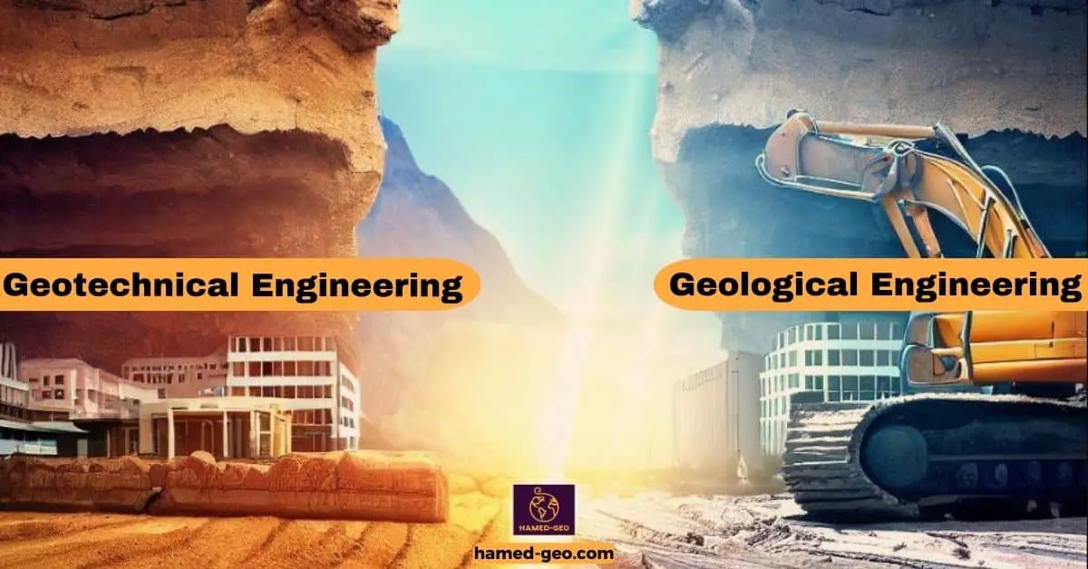
Geological engineering and geotechnical engineering sit next to each other on the same workbench—they both deal with earth materials and the way the ground behaves. But they don’t quite pick up the same tools. One leans into the story of the rocks themselves; the other leans into what those rocks (and soils) will do when we build on them. Similar focus, different lens.
Geological engineering starts with the materials: rocks, minerals, soils—their fabric, strength, weathering, and the odd surprises you only notice after a fresh cut slope. That knowledge carries straight into projects like tunnels, dams, foundations, and slopes, where picking the right alignment or foundation type can make the difference between a quiet asset and an expensive headache. Geological engineers map units, trace contacts, and flag hazards—landslides, karst, faults, even the stubborn swelling clays that look harmless until the first wet season. They don’t just point to the risk; they sketch out ways to live with it: reroute here, reinforce there, drain this, or, well… don’t build that.
Geotechnical engineering, on the other hand, is the practice of turning subsurface reality into numbers you can design with. Boreholes, test pits, SPT or CPT data, lab tests—the whole site investigation routine—to define stratigraphy and parameters: shear strength, compressibility, permeability. With those in hand, geotechnical engineers size foundations for buildings, bridges, and towers; check settlement and bearing; design retaining walls and embankments; and run stability analyses for cuts and fills. It’s analysis and design anchored to how soils and rocks actually behave under load—sometimes linear, often not, and again, sometimes fussy after rain.
The two fields overlap a lot (you know how it goes on real projects). A geological model without design is incomplete; a geotechnical model without geologic context can be misleading. Together they connect the map to the math—so the structure you build sits on ground that won’t argue back, at least not much. Funny enough, that’s the quiet victory everyone wants, even if no one sees it.
Differences Between Geological Engineering and Geotechnical Engineering
Here is a table of comparison table between Geological engineering and geotechnical engineering:
| Aspect | Geological Engineering | Geotechnical Engineering |
|---|---|---|
| Focus of Study | Study of earth's materials, rocks, minerals, soils | Study of soil and rock behavior in relation to structures |
| Scope of Work | Foundation stability, hazard assessment, resource exploration | Construction design, foundation engineering, slope stability |
| Study Areas | Geology, geotechnical engineering, environmental engineering | Soil mechanics, foundation engineering, slope stability |
| Geological Mapping | Collects data for hazard assessment, resource exploration | Provides data for foundation design and stability analysis |
| Environmental Impact | Assesses impact of geological factors on environment | Evaluates impact of construction on ecosystems |
| Mineral Exploration | Identifies mineral deposits and resource viability | Analyzes geological data for mining operation planning |
| Hazard Mitigation | Develops strategies for earthquake, landslide, and flood protection | Designs structures to withstand seismic and geological forces |
| Foundation Design | Ensures safe and stable foundations for infrastructure | Designs foundations considering soil behavior |
| Slope Stability Analysis | Analyzes slope stability to prevent landslides | Evaluates slope stability and designs stabilization measures |
| Soil Mechanics | Analyzes soil properties for engineering projects | Studies soil behavior under different loading conditions |
| Environmental Engineering | Evaluates environmental impact of geological factors | Addresses construction-related environmental concerns |
| Collaborations | Works with geological and environmental engineers | Collaborates with geological and civil engineers |
| Professional Roles | Geological Engineer, Hazard Analyst, Resource Explorer | Geotechnical Engineer, Slope Stability Analyst, Foundation Designer |
Well, the two fields sit side by side, but they don’t do the same job. Geological engineering looks upstream at Earth processes—how rocks, minerals, faults, and, yes, time (a lot of time) shape the ground we plan to use. It reads the landscape, flags natural hazards, and chases resources when they’re there to be found. Geotechnical engineering, by contrast, works right at the contact between soil or rock and the structure. It asks practical questions: Will this clay swell? How much will that foundation settle? Can this slope hold after a week of rain? In practice, the first leans toward surveying and synthesis—tectonics, stratigraphy, landslides, groundwater—while the second focuses on design and construction: foundations, cuts and embankments, retaining walls, ground improvement. Same materials, different questions; the point is, one explains the ground, and the other makes it hold still long enough to build.
Focus of Study
Picking up from the last section—because it’s the obvious next step—what’s the real difference between geological engineering and geotechnical engineering? They sound like twins. They’re not.
Geological engineering zooms out to read the earth’s story: what the ground is made of, how it got that way, and what it might do next. Think mapping formations, noting faults and joints, spotting old landslide scars, and asking the slightly annoying but necessary questions—Is this limestone fresh or weathered? Are there fractures sneaking beneath the site? Where’s the groundwater, really? A geological engineer is trying to predict behavior from processes: erosion, uplift, old tectonic pushes and pulls. The goal is clarity about the setting so projects aren’t surprised later (surprises in rock have a way of getting expensive).
Geotechnical engineering, on the other hand, takes that ground truth and turns it into numbers you can safely build with. Boreholes, SPT blow counts, core logs, lab tests; then bearing capacity, settlement, slope stability, deformation. If you’re designing a foundation, a tunnel lining, or a 20-m (≈65-ft) road cut through mixed soil and rock, the geotech is translating messy geology into pressures, factors of safety, and reinforcement details. The question shifts from “what is this ground and why?” to “how will it carry the load, today and over time?”
Do they overlap? All the time, and that’s kind of the point. Geological engineers sketch the story; geotechnical engineers make the call on how to build within that story—foundations that won’t settle weirdly, slopes that don’t creep after the first rainy season, tunnels that don’t heave at 3 a.m. on a Tuesday. Geological engineers read the terrain, geotechnical engineers decide what to do on it, and sometimes, honestly, the lines blur. But if you keep that zoomed-out vs. buildability lens in mind, you won’t go far wrong—well… except when the site throws you a curve, which it will, eventually.
Scope of Application
People tend to lump geological and geotechnical engineering together. They overlap—of course they do—both care about earth materials and how we build in, on, or around them. But they start from different questions.
Geological engineering asks, what is this ground made of, and how did it get this way? It’s the mapping, the core logging, the “is that a fault or just wishful thinking?” moment on a hot afternoon. Geological engineers study rock, soil, and mineral systems, then pull that story forward into practice: landslides, earthquakes, debris flows; even resource exploration when the project needs it. One week you’re tracing an old shear zone above a road cut; next week you’re modeling how a storm might push a wadi across a planned pipeline corridor—dust on your boots, thin section on your desk. Broad scope, sometimes messy, very real.
Geotechnical engineering, on the other hand, asks, given that ground, how will it carry the load? It’s lab tests, site investigations, settlement estimates, and the quiet satisfaction of a footing that doesn’t move. Geotechs design foundations, retaining walls, embankments, and slopes, and they worry (professionally) about how soil and rock will interact with structures day after day. Less about where the fault came from, more about what that fault means for a hospital foundation at 3 meters, or for a cut slope that keeps wanting to creep—just a little.
Where do they meet? Right at the job site. Geological engineering frames the conditions and the hazards; geotechnical engineering turns that reality into numbers, factors of safety, and buildable details. Different lenses, same ground. And, well, that’s the thing: they’re cousins who share tools but not the exact same toolbox, which is fine.
Tools and Techniques

Geological engineering and geotechnical engineering look at the ground from two different angles, so of course they favor different tools.
For geological engineers, the go-to is mapping — getting out there, recording rock types, structures and how layers sit relative to each other. That kind of field work, combined with satellite photos and aerial imagery, helps them spot the big picture: fault lines, landslide-prone slopes, old volcanic traces — the sorts of things you really want to know before you build. It’s about reading the story of a place, honestly — its history and the hazards that story implies.
Geotechnical engineers, on the other hand, get much more hands-on with the soil and rock you actually plan to build on. They take samples, run lab tests and use specialized gear to measure strength, compressibility, permeability — the hard numbers engineers use in designs. In the field they’ll add seismic surveys or ground-penetrating radar to fill in the gaps between boreholes. So if geology draws the map, geotech checks whether the ground will do the job — and how to make it do the job, if needed.
(Think of it like this: geology tells you what happened and why; geotechnical work tells you how the ground will behave tomorrow. Kind of obvious, but useful to say.)
Overview of Geological Engineering
What do geological engineers actually do? At heart, it’s the place where earth science meets practical building — they study rocks, soils and groundwater so the things we build stay put. Geological engineering is a branch of civil engineering that borrows from geology, geotechnical work and environmental practice. Sounds broad? It is, and that’s kind of the point.
These engineers read the ground like a story: layers, fractures, water paths — all the little details that tell you whether a site is solid or a problem waiting to happen. Their job is to spot geological hazards and then design ways to reduce the risk. That means checking the stability of foundations and earthworks before a single shovel goes in, and designing the fixes — retaining walls, drainage plans, ground improvement measures — that actually keep structures standing.
They also plan and help implement protections against natural threats: landslides, earthquakes, floods — the usual suspects. A geological engineer doesn’t just draw on paper; they test, measure, and sometimes stand in the dust to see how a slope behaves. In short, they make infrastructure resilient and long-lived — not flashy, often unseen, but absolutely essential.
(Yes, it’s a bit nerdy — and honestly, also enormously satisfying when a project holds up the way it should.)
Definition of Geological Engineering
Geological engineering sits where geology and engineering meet — literally the place where the ground and our plans collide. Think of it this way: it’s about knowing what’s underfoot (rocks, soils, groundwater) and using that knowledge to make buildings, roads, tunnels and other stuff safe and long-lasting. Sounds simple, but it isn’t. The ground has its own habits, moods even, and the engineer’s job is to understand them before things get expensive — or worse.
Areas of Study
Geology.
This is the starting point. You learn to read the site: the rock types, the layers, the faults, the story of how the ground got to be the way it is. It’s not just “what’s there” but why it’s there — and that matters when you’re deciding whether a place will hold up a bridge, or slowly settle under a building.
Geotechnical engineering.
This one’s hands-on. It’s about how soils and rocks behave when you load them, dig them, or try to build on them. Foundation design, bearing capacity, slope stability — those are the everyday problems. Want to stop a slope from sliding? That’s geotech. Want a foundation that won’t heave after a storm? Same department.
Hydrogeology.
Water below the surface changes everything. Groundwater pressure, seepage, and the movement of water through pores or fractures can weaken soils, corrode structures, or force you to pump and drain a site before you build. You’ll learn to map flow, predict where water will go, and design around it — or with it.
Geochemistry.
Rocks and soils have chemistry, and that chemistry can be a silent troublemaker. Salty groundwater, acid-forming minerals, or aggressive sulfate soils can damage concrete and steel over time. Geochemical insight helps you choose materials and treatments that last.
In short, geological engineering is practical and a little messy. It mixes fieldwork, lab tests, and design thinking. You need observation skills, judgement, and yes — patience. Because the ground doesn’t read drawings; it reacts to them. So good engineers learn to listen first, design second, and then keep a close eye on what actually happens.
The Role of Geological Engineering
If you’ve ever watched a hillside after a week of hard rain and wondered, is that going to move?, you’re already thinking like a geological engineer—at least a little. Their day-to-day work sits right at the seam between the ground beneath us and the things we try to build on it, which sounds obvious, but it’s where trouble likes to hide.
A big slice of the job is reading the land for risks: earthquakes that might shake a bridge before dawn, slopes that could slump after a storm, a restless volcano that clears its throat once in a century and then, well… doesn’t whisper. They pore over fault maps, cores pulled up from sticky clay, water levels that creep higher than they should. The point isn’t doom; it’s foresight—turning messy earth processes into plain decisions like “move the school 200 meters east” or “tie this hospital to bedrock and add more drainage.” You’d be surprised how much damage a well-placed ditch can prevent.
On the other hand, not everything is hazard sirens. A lot of it is quiet, careful design. When someone sketches a building, a geological engineer is the one saying, let’s see what the ground can actually carry. They test soils—sand that drains too quickly, fat clays that swell after the first big rain, gravel that behaves, mostly—and check how groundwater is moving. Then they size the foundation: shallow pads where the crust is stiff, deep piles when it isn’t, sometimes a mat that spreads the weight like a snowshoe. It’s not glamorous, but it keeps floors level and doors from sticking in August.
Site choice matters just as much. Two plots can look identical from the road, and only one will sit on a buried channel full of soft silt. So they walk the site, drill a few boreholes, compare old aerial photos, and ask the annoying questions early. Is there a hidden fault trace? Are we over a former lagoon? Will the water table rise in winter? A yes doesn’t kill the project; it just changes the plan—better drainage here, a setback there, a different foundation type altogether.
All of this—hazard checks, foundation design, the slightly fussy business of matching structures to soils—adds up to something simple: people go about their lives without thinking about the ground too much. Which is, ironically, the goal. When the lights stay on after a quake, when a hillside holds through a soaked season, when a new road doesn’t ripple after the first summer, that’s geological engineering doing its work, mostly unnoticed, and that’s fine by them, by all of us, really.
Overview of Geotechnical Engineering
If you’ve ever watched a new building go up and wondered, can the ground really handle all that?, you’re already brushing against geotechnical work. It’s the corner of civil engineering that deals with, well, dirt and rock—but not just that—how those materials push back when we load them, soak them, or shake them.
Day to day, the field splits into a few faithful themes: soil mechanics (how sand, silt, and clay behave under pressure), foundation design (pads, piles, mats—whatever keeps a structure steady), and slope stability, which is the gentle art of persuading a hillside to stay put after a week of rain or a quick tremor. Simple on paper, trickier in mud.
The thing is, structures and soils don’t ignore each other. They trade forces. A stiff frame on soft clay might settle unevenly; a lighter building could float a little if the groundwater rises—annoying, but fixable. That back-and-forth is what we call soil–structure interaction, and it’s why rules of thumb rarely survive first contact with a real site.
So before anyone draws the final footing line, there’s an investigation. Boreholes go in on a tidy grid; the drill brings up split-spoon samples that thud or bounce depending on what’s down there. You count the blows—eleven, twelve, twenty-two—and make a tiny note when the clay smells a bit swampy. Water levels get logged once, then again after rain, because they wander. Old aerials are checked to see if the “flat lot” used to be a stream bend; funny enough, it often did.
All that fuss has a straightforward payoff: pick the right foundation, spot the risks early, and keep the finished structure calm through seasons and storms. It’s careful work, sometimes a little fussy, and that’s fine—quiet buildings and steady slopes don’t make headlines, which is sort of the point.
Definition of geotechnical engineering
If you’ve ever stood on a job site and felt the ground thrum under your boots when a truck rolls by, you already know the question that keeps geotechnical folks busy: how will this ground behave when we ask it to carry our stuff? Buildings, bridges, a tunnel that sneaks under a river—real loads, real consequences.
Geotechnical engineering sits at that seam between earth and structure. In practice, it’s a mix of science and, honestly, good field sense. We test soils and rock—how sand drains, how clay swells after a hard rain, how weathered shale pretends to be strong until it isn’t. From there, we shape the design: choosing shallow footings where the crust is stiff, deep piles where it isn’t, or a mat that spreads weight like a snowshoe when the subgrade gets fussy.
The thing is, structures and soils talk back and forth. That’s soil–structure interaction in plain language. A flexible frame might shrug off a bit of settlement; a rigid deck might crack if the groundwater nudges up a few centimeters. So we model, but we also listen to the site: SPT blow counts called out over the drill’s rattle, cores laid out on a dusty tarp, groundwater readings taken twice because the first one, you know, lies after a storm.
Safety is the headline, but efficiency matters too. The goal is simple enough—keep people safe, keep projects buildable, and avoid surprises that show up at 2 a.m. on a wet Tuesday. That might mean shifting a retaining wall to miss a slick clay seam, adding drains behind it, or recommending grouting where a karst void opens under a neat rectangle of future parking. Not glamorous, but doors don’t jam in August and pavements don’t ripple in July, which feels like a quiet win.
The field ranges wide: soil mechanics, foundation engineering, slope stability, even how the ground behaves when an earthquake turns it—for a moment—into something closer to jelly. We lean on investigations and site characterization to map what you can’t see: boreholes in a tidy grid, lab tests with names too long, old aerials that reveal a buried creek meander right under the “perfect” lot. Sometimes there’s a slightly awkward note in the log—soft silt, smells marshy, hmm—that ends up steering the whole design.
In the end, when a bridge settles into place without fuss and a basement stays dry through the spring melt, that’s geotech doing its job. Quietly. The kind of success you don’t notice because nothing went wrong, which is, well, exactly the point.
Areas of Study
If you’ve ever watched a survey crew flag a perfectly ordinary-looking lot and thought, why all the fuss over plain dirt?, you’re already brushing up against geotechnical work. It’s the corner of civil engineering that deals with how soil and rock behave—and how our structures behave back—when we load them, shake them, or soak them.
The field spreads out into a few familiar lanes. Foundation engineering is the big one. We match the ground to the structure: shallow footings on a stiff crust, deep piles where the strong layer hides, sometimes a mat that spreads weight like a snowshoe when the subgrade is moody. It sounds tidy; it rarely is. A patch of fat clay can swell after a summer storm and make doors stick, a tiny thing that tells you a lot.
Earthquakes add their own mischief. Geotechnical earthquake engineering asks what happens when the ground stops acting like a solid for a moment—liquefaction in a river plain, amplified shaking in soft bayside fill, that kind of thing. We’re not guessing. We run site-specific spectra, check old records from nearby stations, and—honestly—trust the odd gut note from a core that comes up too loose for comfort.
Before any of that turns into drawings, there’s the investigation. Boreholes in a neat grid, split-spoon samples that thud or bounce depending on what’s down there, blow counts called out over the drill’s growl—ten, eleven, twenty—because rhythm matters. Groundwater gets measured, then measured again after rain. Old aerial photos get pulled to see where a creek used to wander under today’s parking lot (funny enough, it’s still a creek, in spirit). Site characterization is the map you build for a place that mostly hides.
The purpose behind the fuss is simple enough: stable, safe, predictable structures. Bridges that don’t settle into a tilt by year three. Basements that stay dry through spring. A slope that holds after a week of hard rain because you added drains and a bit of reinforcement, just in case. Sometimes the recommendation is glamorous—grout curtains, seismic base isolation; sometimes it’s a politely worded memo that says, move the building twenty meters east, please.
It’s technical work with muddy boots. Notes in the log read a little human—soft silt, smells marshy, hmm—and, yes, a comma ends up where it shouldn’t. But that’s how it goes on real sites. When nothing dramatic happens later—no rippled pavement in July, no hairline cracks by Thanksgiving—that quiet is the result. Which is, well, the point.
The Role of Geotechnical Engineering
If geological engineering is the wide-angle view of the landscape, geotechnical is the close-up—the handful of soil that sticks to your glove and tells you more than the map did. It’s the part of civil engineering that asks, in plain terms, how will the ground and our structures get along? Sometimes they’re friends. Sometimes, not so much.
Day to day, geotechnical folks read sites the way a doctor reads a chart. They sample the subsurface, check how sand drains and how clay swells after a hard rain, and then they stitch that information into the foundation plan. Shallow footings where the crust is stiff; deep piles when the good layer is hiding; a mat that spreads weight like a snowshoe if the subgrade gets, you know, moody. The goal isn’t fancy—it’s safe and sensible—but it counts.
A big responsibility is figuring out whether a site is ready for what we want to put on it. That means walking the ground, drilling a few boreholes, listening to blow counts called over the rig’s rattle—twelve, thirteen, twenty—and noting the little clues: a marshy smell, a silt layer that smears instead of breaks, groundwater that sits a bit higher after last night’s storm. Risks get flagged early, and the design shifts: drains here, a setback there, maybe rotate the building to miss a soft pocket. Small changes, big difference.
There’s also that conversation between soil and structure—soil–structure interaction—which is never one-way. A flexible frame can ride out a touch of settlement; a rigid deck may complain if the clay beneath it swells a few millimeters too far. Bridges, dams, buildings: each one pushes and the ground pushes back, and in that back-and-forth the details matter. Funny enough, a well-placed gravel trench can be as heroic as a row of deep piles, if you catch the problem early.
In the end, good geotechnical work feels almost invisible. Doors don’t stick in August, embankments don’t slouch after a week of rain, and the new culvert stays put through spring flood. Quiet success. Maybe a comma out of place in the field log, a slightly awkward note—soft silt, smells like pond, hmm—but the decisions are clear, and the structure settles into the site like it belongs there. Which, honestly, is the whole idea.
Areas of Overlap Between Geological and Geotechnical Engineering
On paper these topics look like separate boxes—investigations, foundations, hazards—but in the field they blur together, you know, like footprints after a sudden rain. Geotechnical and geological work share the same ground, literally, and they talk to each other all day.
Start with the investigation. You drill a few boreholes, watch the cuttings change from clean sand to stubborn clay, count SPT blows over the rig’s clatter—eleven, twelve, twenty—and bag samples that smell a little marshy. Lab tests follow: grain size, Atterbergs, shear strength. All of that is just a way of asking, what can this soil and rock carry, and what will it try to do when it gets wet, dry, or shaken?
Those answers feed straight into foundation engineering. Shallow footings when a stiff crust sits near the surface; deep piles or drilled shafts when the competent layer hides down below; sometimes a mat that spreads the load like a snowshoe because the subgrade is, well… moody. Details shift with groundwater, with layering, with that thin silt seam you almost missed until it smeared across your glove. The design isn’t separate from the site—it’s a translation of it.
Meanwhile, geologic hazards are not a side note. They’re the weather in the background that can turn the whole plan sideways. A hillside with old scarps after a wet winter, a fault trace that clips the corner of a lot, liquefiable sand along a river plain—each one changes what “safe” means. You add drains behind a wall, flatten a slope a few degrees, or move the building pad twenty meters east. Small moves, big consequences.
Site characterization ties it all together. Maps, logs, old aerial photos that reveal a wandering creek under today’s tidy parking lot; groundwater levels taken twice because the first reading—after last night’s storm—was lying a bit. Geotechnical testing turns those notes into numbers you can design to, but the field sketch with the crooked arrow—soft clay here—still matters.
In the end, it’s one workflow, not five. You learn the ground, you respect the hazards, you choose a foundation that fits. If the doors don’t stick in August and the embankment stays quiet through the fourth heavy rain, that’s success—the kind that doesn’t make a headline, which is exactly, honestly, the point.
Geotechnical Investigations
If you’ve ever watched a drill rig set up on a “boring” parking lot and wondered why all the fuss over a few holes in the ground—well… that’s where geotechnical investigations earn their keep. They’re the way we learn what’s hiding beneath the surface: layers of sand that drain fast, clays that swell after a storm, a water table that sits higher than anyone expected on a Thursday.
The work starts simple. You collect soil and rock, listen to blow counts called over the rig’s clatter—ten, eleven, twenty—and bag samples that sometimes smell faintly marshy. Groundwater gets checked, then checked again after rain because it wanders. In the lab, numbers arrive—grain sizes, Atterbergs, shear strengths—and suddenly a site that looked flat becomes a story with chapters and a couple of plot twists.
Those pages feed straight into foundation engineering. If a stiff crust lies near the surface, shallow footings make sense. If the strong layer hides deep, you shift to piles or drilled shafts. Sometimes the subgrade is moody and you spread the load with a mat, like a snowshoe. The choice isn’t abstract; it’s stitched to the soil’s behavior—how it compresses, how it creeps, how it behaves when August dries it out and January soaks it again.
And then there are the hazards. Not a separate topic, really, more like the weather in the background that can change everything. A slope with old scarps after a wet winter, a liquefiable sand lens along a river plain, a quiet sinkhole hint in a limestone valley—you see them in the logs and on old aerials and, sometimes, in that awkward note on the field sheet: soft silt here, looks pondy, hmm. Catch them early and you can design around them: add drains, flatten a grade, move the building pad twenty meters east. Small moves, big safety.
In the end, investigations, foundations, hazards—they’re one loop. Learn the ground, choose what fits, and keep people safe without making a fuss. When doors don’t stick in late summer and the embankment stays put after a week of rain, the work disappears into the background, which is exactly, honestly, the point.
Foundation Engineering
Think of foundation engineering as the handshake between the ground and whatever we’re bold enough to build on it. Buildings, bridges, dams—the glamorous parts—only behave if that handshake is firm, which, honestly, depends on dirt and rock that don’t look glamorous at all.
It starts with the subsurface story. Geotechnical investigations put numbers—and a few smudged field notes—behind what lies underfoot. Boreholes, core runs, blow counts called over the rig’s growl—ten, eleven, twenty—and water levels that seem to rise just when you wish they wouldn’t. In the lab, soils get prodded, spun, squeezed; rocks are crushed and logged. Out of that comes a picture: where the stiff layer sits, how the clay swells after rain, whether a thin silt seam might shear when it’s least convenient.
Design grows straight from those facts. If there’s a competent crust near the surface, shallow footings make sense. If the good stuff hides deep, you reach for piles or drilled shafts. Sometimes the subgrade is fickle and a mat foundation spreads the load like a snowshoe. Tiny details steer big choices—a sand lens that drains too quickly, a weathered shale that pretends to be strong until it isn’t, a groundwater table that, well… won’t mind its business.
Hazards aren’t an afterthought; they’re the background weather. Geologists and geotechnical engineers walk the same ground and compare notes: old landslide scarps along a cut, a fault trace that clips the building pad, karst hints where the limestone goes hollow, the quiet kind of trouble. The response can be simple—drains behind a wall, a slope flattened a few degrees, the footprint nudged twenty meters east—or it can be muscular: ground improvement, tiebacks, base isolation when shaking is the real concern. The point is to know before you pour.
Testing ties it together. Triaxials, consolidation, point load on rock; even the humble Atterberg limits that tell you a clay will either behave or sulk after a storm. Numbers land in a table, sure, but the field sketch with the crooked arrow—soft silt here—still matters. A slightly awkward note in the log can save a very expensive fix later.
In short, foundation engineering is where geology and geotechnics overlap so completely you stop seeing the seam. Learn the ground, respect the hazards, choose a foundation that fits. When doors don’t stick in August and the bridge bearings sit level through the third wet winter, the work disappears into quiet, which is exactly, honestly, the goal.
Geologic Hazards
Geologic hazards don’t just sit in the background; they nudge almost every big decision in geological and geotechnical engineering. If you’re planning a road cut, a school, a hospital—anything that has to keep standing when the ground misbehaves—you care about them a lot. And well… the ground does misbehave.
A site investigation is where this gets real. Engineers look for the usual suspects—landslides, earthquakes, flooding—but also the quieter risks that creep up on you: soft layers, swelling clays, a shallow water table that rises after a week of rain. By reading the ground (boreholes, logs, local history, even what the neighbors remember), they map out what could go wrong and how likely it is. The goal isn’t fear; it’s foresight.
Foundation design is where those findings cash out. The soil and rock under a building decide more than the drawings do. Weak or collapsible soils can settle, sometimes a little, sometimes too much—and sometimes unevenly, which is worse. With good data, you can choose what survives: maybe a raft slab, maybe piles down to a stiff stratum, maybe ground improvement so the “bad” soil becomes good enough. It’s not glamorous, but it keeps doors from sticking and beams from cracking, which is the whole point.
Testing ties it together. You can’t design on hunches—so you sample, you run SPTs or CPTs, you check shear strength and compressibility, you verify drainage paths. Then you loop back: does the design match what the tests actually say, or is there a blind spot? On the other hand, sometimes the answer is simple: do another boring; one more meter tells the story. It sounds a bit fussy, maybe even repetitive, but that careful checking is what turns hazard into handled.
Benefits of Geological Engineering
Geological engineering does a lot of its best work quietly. Mapping comes first—careful field notes, cross-checking old surveys, and the kind of patient data cleanup that shows where faults actually run and where the ground is just pretending. That map, you know, is what lets roads, pipelines, and neighborhoods land in the right places instead of the risky ones.
Then there’s the hunt for resources. Not just “find the ore, dig the hole,” but figuring out which deposits are real, which are economical, and how to pull them out without chewing up everything around them. It’s practical, sometimes stubborn work.
On the other hand, every project leaves a footprint. Environmental impact assessments slow everyone down a little—on purpose—so we can see how construction might nudge rivers, dunes, or groundwater, and how to soften those nudges before they become problems. When a site is already in trouble—spilled fuel, lingering metals—the job shifts to testing, then to cleanup and monitoring. It’s less dramatic than it sounds, and more exacting.
Groundwater, needs watching. Wells rise and fall with seasons, with pumping, with luck; setting sustainable limits is how towns and farms keep the taps running next year and the year after. Funny enough, the “small” choices here add up to the big outcomes elsewhere.
Put together—mapping, exploration, impact work, cleanup, and water stewardship—they’re all steering toward the same thing: building what we need while keeping the ground we stand on intact. Which is the point, really, sometimes said twice because it bears repeating.
Geological Mapping and Data Analysis
Geological mapping sits right at the heart of the job. You walk a valley or scroll a satellite scene, sketch contacts, mark a fault that cuts across a wadi, then puzzle over why one ridge is tougher than the next. Bit by bit, the picture sharpens: rock types, breaks in the ground, the quiet hints of old movement. With that kind of map in hand, engineers can choose where to put a road or a hospital, and where to absolutely not—because the ground has a memory of its own.
Data analysis, doesn’t just live in spreadsheets. It’s survey notes, borehole logs, remote-sensing tiles, geophysical sections—the whole messy pile. Look long enough and patterns start to nudge you: a line of microquakes bending along a buried fault; rainfall plus slope angle that, together, spell trouble. If the seismic record hums a little louder in one corridor, you design for it; foundations get deeper, joints get smarter. It’s not drama, just prudence.
And then there’s slope stability—the everyday, slightly nerve-wracking part. Cliffs and cuttings that seem fine at noon look different after a week of rain; funny enough, a single thin clay layer can turn a tidy hillside into a slow-moving mess. With modern software, you test scenarios, push the factors of safety, and—when it’s needed—spec a wall, drains, anchors, maybe all three. It’s careful work, sometimes fussy work, but that’s how you keep roads open and neighborhoods quiet, really quiet.
Mineral and Resource Exploration
Think of geological engineering as the earth’s backstage crew — they don’t always get the spotlight, but without them you wouldn’t know where to look. They read rock layers the way a detective reads clues: lines, colors, tiny grains, and where things are folded or broken. From that, they can point to spots that might hide valuable minerals — and decide, reasonably quickly, whether it’s worth digging deeper.
How do they do it? A mix of tools and old-fashioned field sense. They run geophysical surveys to “see” anomalies below the surface, pick and test rock samples to learn what minerals are actually present, and sketch maps that stitch those bits of data together. Put it all into a 3-D model and you’ve got a working map of the subsurface — not just pretty lines on paper, but a guide you can stake decisions on.
Why does it matter? Because good geological work saves time, money and, yes, the land. Finding and accurately assessing deposits helps mining companies and investors avoid dead ends. It also makes mining smarter: better planning, higher recovery, and fewer surprises that damage the environment. In short, geological engineering doesn’t just find resources — it helps us use them more carefully, which, frankly, is a pretty big deal.
Environmental Impact Assessment
Think of an environmental impact assessment as a project’s reality check — not just a stack of forms, but a practical look at what a project might do to land, water, and living systems, and what we can do to stop the worst of it. It’s central to geological engineering because the ground itself keeps the score: change the subsurface, and rivers, wells, and ecosystems will notice.
Good assessments start with solid geological mapping and data work. Maps, borehole logs, lab results and a few stubborn spreadsheets — they tell the story: where the bedrock is shallow, where loose sediments could let a contaminant run, where slope failure might be triggered. Engineers use that data to spot real risks (sinkholes, contamination plumes, groundwater drawdown) and to model how those risks could play out — short term, long term, worst case.
When a site is contaminated, the job becomes detective work. You trace the contaminant: what it is, how it moves through soil and water, where it’s likely to concentrate. Then you size the problem and pick remedies — removal, in-situ treatment, pump-and-treat, containment, or natural attenuation, depending on what will actually work. The point is simple: reduce exposure so people and nature aren’t left paying the bill later.
Groundwater deserves special attention because it’s easy to miss but vital. A project can change groundwater levels or quality far from the work site — imagine a village well going salty after nearby excavations. So geological engineers design monitoring networks, set protective zones, control dewatering, and sometimes add managed recharge or treatment steps. Practical, enforceable measures — not just good intentions — make the difference.
In short: EIA in geological engineering is about reading the ground carefully, calling out the hazards, and building realistic fixes. It’s not glamorous, but it’s how we keep projects from turning into long-term problems, and yes, the paperwork matters, because that’s the map everyone follows later.
Benefits of Geotechnical Engineering
Think about the road outside your door or the house next to it — someone had to make sure the ground would behave. Geotechnical engineering is that practical kind of thinking: it reads the soil (how it compacts, how it drains, how it settles) and uses those clues to pick better foundations and stabilization methods. Do the tests early, choose the right fix, and you end up with structures that last — fewer surprises, fewer emergency repairs. It’s also the reason slopes don’t suddenly slide away: careful slope-stability work spots trouble before it becomes a disaster. So, when engineers apply geotechnical principles properly, projects tend to be safer, cheaper over time, and more sustainable — not magic, just good groundwork, literally. Kind of unglamorous, but honestly, it’s the thing that keeps everything standing.
Soil Mechanics
We’ve talked about geological engineering, but geotechnical engineering is the one that really keeps our built world steady. It’s the practical, hands-on branch that studies soil and says, “Okay, this will hold — or it won’t.” Sounds simple, but you’d be surprised how often the ground underfoot is the thing nobody notices until something goes wrong.
At its heart is soil mechanics. That’s where engineers test dirt — in the lab and on site — to learn how it behaves under loads: how much it squishes, how it shears, how fast it settles. From those numbers we pick a foundation depth, choose footing sizes, and estimate long-term settlement. Those tests tell us whether a column will stand firm for decades or slowly sink, and, honestly, that difference matters.
Then there’s slope stability — the quiet, crucial work that prevents hillsides, embankments, and cuts from becoming failures. You look at soil strength, groundwater, the slope shape; you run analyses; and you decide on fixes: better drainage, gentle regrading, anchors, or stronger compaction. Each site has its own quirks, so the solutions aren’t one-size-fits-all. The thing is, small details (a perched water table, a weak bedding layer) change everything.
So yes — geotechnical engineering may feel a bit behind-the-scenes, but it’s what makes structures safe and predictable. It turns messy, unpredictable ground into something you can build on, plan for, and trust. Would you rather guess, or know? Exactly.
Foundation Design
Ever wonder what actually keeps a building from slowly sinking or cracking? It’s the foundation — and the job of geotechnical engineering is to make sure that base behaves the way we want it to.
In practice, foundation design is about studying the ground. Engineers look at soil the way a doctor looks at a patient: tests, measurements, a bit of interpretation. Soil mechanics tells them how the ground will carry weight, how water in the ground might change things, and how the whole system reacts if the earth shakes. With that, they pick solutions that spread the load so the structure sits evenly — not lopsided, not settling different amounts in different places.
So what does that choice look like? If the soil is firm and near the surface, shallow footings often do the trick. If you hit soft layers or need to reach stronger ground, deep piles are the answer. And sometimes you need a hybrid or a custom fix — a raft foundation, helical piles, or something slightly out of the ordinary — depending on groundwater, seismic risk, and site quirks.
Good foundation design mixes numbers and judgement. You run lab tests and put borings in the ground, sure, but you also factor in local surprises — a high water table, reclaimed land, or a lens of loose sand. Engineers usually build in a margin of safety, because nature has a way of surprising you.
Bottom line: foundation design isn’t just paperwork. It’s careful, practical problem-solving that keeps structures standing, day after day. It’s precise, yes, but also a little humble — the quiet part of construction that does the heavy lifting, literally.
Slope Stability Analysis

Ever stood at the edge of a slope and wondered, “what keeps this from sliding away?” Slope stability analysis answers that question. It’s not just a set of calculations — it’s a careful look at the soil, the rock, the water moving through them, and how all those things might conspire to fail. Think of it as detective work: engineers collect clues (samples, water pressures, topography), piece them together, and try to see what could go wrong.
Why bother? Because a failing slope can be catastrophic — landslides, damaged roads, ruined foundations, people at risk. By studying the ground and mapping likely failure mechanisms, engineers can pick solutions that actually work: better drainage, regrading the slope, retaining structures, soil nails, vegetation — or a combination of these. The right fix protects lives and saves money down the line; you’d rather design for safety up front than scramble to repair something that gave out.
There’s another side to it, too. Good slope analysis helps you build smarter, not just safer. When you understand how the ground behaves, you can choose the right foundation, construction method, and materials — often arriving at a more cost-effective, long-lasting design. In short, it’s practical science plus judgement, and yes, a little experience. So: thorough analysis = fewer surprises later, and a lot more peace of mind.
Careers in Geological Engineering
Curious about careers that work with the ground beneath our feet? Geological engineering really covers a few different roles — think geologists, mining engineers, and geological engineers — all connected, but not the same.
Geologists read the story written in rock. They map layers, identify minerals, and piece together how Earth’s crust formed and changed. Lots of careful observation, notes, samples — the slow, steady detective work of the field.
Mining engineers, by contrast, plan how to remove those minerals. They design pits and shafts, run the numbers for safe extraction, and figure out logistics — drilling, blasting, hauling — the whole production side, really.
Geological engineers sit between those two worlds. They use geological knowledge to solve engineering problems: foundations, tunnels, slope stability, building on tricky ground. Geological engineers, often, are the ones who make sure that what gets built actually stays standing.
It’s satisfying work, but not without risk. Field teams and engineers deal with real, tangible hazards — landslides, earthquakes, sudden rockfalls — and that reality shapes how every project is planned and run. Scary at times? Sure. Vital? Absolutely.
Geologist
What do geologists actually do on an engineering project? Short answer: a lot more than you might think. They read the ground — its layers, its history, the little hints in rocks and soils — to figure out how the Earth beneath a site will behave when we start building on it.
In practice that means boots-on-the-ground fieldwork and lab work. Geologists walk sites, map rock units, take samples, then analyze data to judge whether a spot is safe for things like dams, tunnels, or highways. They look for the subtle stuff — fissures you might not notice, groundwater sneaking through a seam, soil that looks fine until it’s wet — and translate all that into practical advice.
A big part of the job is spotting hazards. By reading rock formations and soil characteristics, geologists flag stability problems and propose fixes. Want to avoid a landslide? They’ll recommend the right support systems. Worried about quakes? they’ll suggest foundation designs that stand up to shaking. Simple, but crucial: the right geological advice early on can save a ton of trouble later.
They’re also key players in environmental assessments. Geologists evaluate how a project might change the local ground and water, then suggest ways to limit harm — things like drainage fixes, slope protection, or choosing a different alignment altogether. It’s about building smarter, not just building bigger.
So, in short: geologists give the team a clear read on the ground — the risks, the limits, and the practical solutions. You could think of them as the project’s early-warning system, and, honestly, the people who quietly help make sure our engineering plans don’t fall apart once the first rains hit.
Mining Engineer
Thinking about career directions inside geotechnical engineering? One clear path is mining engineering — and honestly, it’s a lot more varied than most people assume. At its core, a mining engineer figures out how to get valuable rock and minerals out of the ground in a way that actually works: designing mine plans, deciding how to sequence work, and solving the day-to-day technical puzzles that keep a site running. They might sketch slope angles for an open pit one day, plan ventilation for an underground drive the next, and figure out where to stage heavy equipment so everything flows.
They’re, kind of, the bridge between the geology and the machines — translating drill logs and maps into practical steps: where to dig, how much ore is worth extracting, and how to do it with worker safety and the environment in mind. Which means the job isn’t just technical — it’s regulatory, too. You’ll spend time navigating permits and rules, thinking through tailings or water management, and making choices that reduce environmental harm while keeping operations feasible.
Is it risky? Sometimes. Conditions can be tough, and safety is never optional. But the flipside is rewarding: you get to lead big projects, see plans become real, and influence how resources are developed responsibly. If you’re interested, start with hands-on site experience and technical courses, read the field’s journals, and join a professional body — there are plenty of societies and local groups that help with training and networking. Ask someone who’s been in the field what a typical week looks like; I promise you’ll learn more in that conversation than from a brochure. (And yes — internships matter, a lot.)
Geological Engineer
Think of geological engineers as the people who read the ground so everything we build can actually stay put. They’re the boots-on-the-ground experts who turn messy field observations — rock cores, borehole logs, lab results, a lot of maps — into practical designs and decisions. Sounds simple? It isn’t. But the idea is straightforward: figure out what the earth will do, then design to live with it.
Their day-to-day work centers on assessing ground stability and choosing how to support structures. Foundations, retaining walls, slope-stabilization systems — those are the usual suspects. To get there they use soil and rock mechanics, field mapping, lab testing and modelling; sometimes it’s hands-on (sampling), sometimes it’s desk-bound (interpreting graphs), and, yes, sometimes it’s a bit of both. They also advise on where to site roads, tunnels, mines or dams so those works don’t fail later — because when the ground moves, people notice, quickly.
You’ll find them on all sorts of projects: highways and bridges, coastal defenses, pipelines, open-pit mines, even the odd urban redevelopment where buried geology is a surprise. Their work is about reducing risk — making sure slopes won’t slide, foundations won’t settle, that groundwater won’t undermine an excavation. Who wants a road that slumps after the first heavy rain? Exactly.
It’s not all neat lab reports. Geological engineers often work in remote, dusty, or otherwise hazardous places mines, steep slopes, construction site where physical and chemical hazards are real. They sometimes have to make tough calls with incomplete data, which is stressful, but also why their judgment matters. And honestly, after a long day of balancing field evidence and engineering judgement, there’s a real sense of reward when a design holds up — it’s practical, important, and kind of satisfying.
Careers in Geotechnical Engineering
Thinking about careers that deal with the ground beneath our feet? There are a few closely related routes you’ll hear about: geotechnical, environmental, and civil engineering. Geotechnical engineers are the ones who read the soil and rock — testing, modeling and designing foundations, slopes, tunnels and the like basically making sure whatever we build won’t tip, slip or settle unexpectedly. Environmental engineers focus on how our work affects the air, water and land; they design solutions for waste, pollution control and site cleanup, you know, the practical fixes that keep people and ecosystems safer. Civil engineers tie the whole thing together: they plan and design roads, bridges, water systems and other infrastructure, then coordinate the build budgets, contractors, schedules — to make it actually happen. So, which of those sounds like your kind of problem to solve? small, deliberate quirks: a conversational aside (“you know”), a slightly loose clause, and a modest repetition to keep the voice human.
Geotechnical Engineer
Geotechnical engineering sits at that practical crossroads where dirt, rock, and design meet—sometimes politely, sometimes not. At its heart, it’s about understanding how soils and bedrock behave and then using that knowledge to build things that stay where we put them: foundations that carry the load, tunnels that don’t close in on themselves, retaining walls that keep a slope where it belongs. Sounds straightforward until a storm arrives, or a hillside starts whispering that it wants to move.
A big part of the job is reading slopes. Is that hillside stable, mostly stable, or—honestly—already on the move? We look at the fabric of the ground: grain sizes, moisture, fractures in rock, old slip surfaces that tell on themselves. Then comes the math and modeling: factor-of-safety checks, shear strength parameters, pore pressures that rise when the rains do. Sometimes the fix is gentle—reinforce the soil with geogrid or nails, trim the geometry a touch—and sometimes it needs a wall, a proper wall, or drainage that quietly lowers the groundwater so the whole mass relaxes and stops creeping.
Before any of that, we go find the ground as it truly is, not as the drawings hope it will be. That’s the site investigation—borings in key locations, test pits where access allows, sampling that keeps the structure intact if we can. We pull undisturbed samples, we bag the disturbed ones; the lab gets busy with Atterberg limits, consolidation tests, triaxial shears, and a few index tests that tell you more than you’d expect. The numbers aren’t the whole story, but they’re the part that holds up in daylight (and in court, if we’re being candid).
All that data folds back into design: footing sizes adjusted to real bearing capacity, pile lengths tuned to the layer that actually carries, tunnel linings chosen for the stress path they’ll see, not the one we wish they’d see. On sandy flats or along a wadi bank after a hard rain, the recommendations shift—more drainage here, a toe berm there; in soft clays, patience and staged loading; in stiff rock, watch the discontinuities more than the compressive strength. The thing is, every site has a personality, and it’s rarely shy about showing it.
In the end, geotechnical work is part detective story and part quiet negotiation with the ground. We listen, we test, we model; then we make practical calls so that what’s built stays safe—day one and year twenty. It’s fairly simple, and also not simple at all.
Environmental Engineer
Switching from geological engineering into geotechnical work can open more doors than you expect—one of the most natural next steps is environmental engineering. If you’ve ever stood on a site with dust in your teeth and a soil log flapping in the wind while the excavator grumbles behind you, you already know how closely these worlds overlap.
Environmental engineers are the folks who make sure projects don’t trip over regulations or, worse, harm the ground and water we rely on. They work side by side with geotechnical teams to map out where the risks really sit: is that fill material clean, what happens when the water table rises after a storm, could a cut slope send fines into a nearby wadi or creek? By testing soils and checking groundwater chemistry—sometimes the lab confirms your hunch, sometimes it doesn’t—they flag contamination concerns early, before they turn into costly change orders.
Their job isn’t only about “don’t do harm.” It’s also about building smarter. That can mean designing silt control that actually survives a surprise downpour, choosing lower‑carbon materials where the spec allows, or rethinking haul routes so you’re not burning fuel just to move the same sand twice. Funny enough, the small choices—an extra swale here, a better stockpile cover there—often add up more than the glossy sustainability slide deck.
To do this well, a solid geotechnical foundation really matters. Slope stability isn’t just an equation on paper; it’s knowing when that clay layer will slick up after a week of humidity, and how a shallow failure could carry contaminants downslope. Geotechnical site investigations—borings, test pits, in‑situ tests—give the environmental picture real depth, because you can’t manage what you can’t characterize, you know?
The thing is, dirt remembers. Regulations and environmental standards evolve (sometimes faster than we’d like), so staying current is part of the craft: permits, threshold limits, sampling protocols, reporting formats the whole alphabet soup. Keeping up means your designs don’t just pass review; they work in the field, which is the point. Not just on paper, but on the ground. On the ground is where it matters.
If you’re already comfortable reading the subsurface—the stories in a core run, the odd behavior of a sabkha‑like crust after rain—then environmental engineering is less a leap and more a step sideways, well… sideways and a little forward. The vocabulary shifts, the responsibilities broaden, but the instincts you’ve built carry over beautifully.
Civil Engineer
Civil engineers quietly shape the ground we take for granted. Walk across a bridge, watch a new road cut across a wadi after the rains, and you’re seeing their handiwork—sometimes obvious, often invisible. Geotechnical engineers sit at the heart of that work. They worry about what the earth itself is doing (or planning to do), which sounds a bit dramatic, but isn’t.
In practice, geotechnical engineering is about how soils and rocks behave when we ask them to carry loads, move water, or hold a slope. Clay that swells after a week of rain, sandy layers that drain too quickly, a hard looking limestone that turns out to be riddled with joints you know, the little surprises. These engineers test and interpret those properties, then turn them into decisions: what kind of foundation goes under a hospital, how an embankment should be layered and compacted, whether a tunnel lining needs extra reinforcement right where the rock mass gets finicky. Not just rocks, but rock behavior.
They don’t work in a vacuum. Environmental engineers are in the room asking, “What does this do to groundwater? To dust, to runoff?”—so the design doesn’t fix one problem and create two more. Geological engineers map the deeper story: faults, old marine beds, weak horizons that don’t look weak until you core them. That map quietly steers everything from the first site walk to the final drawing set. Funny enough, a good geologic cross-section saves time twice—first in design, then again in construction.
And then there’s slope stability, the thing that sounds simple until it isn’t. When geotechnical folks run a stability analysis, they’re checking whether a slope or embankment will keep its shape through heavy rain, earthquakes, or just long, slow weathering. Think of a roadside cut after a khareef season near Salalah, or a levee protecting an industrial pad where the ground stays soft longer than anyone expects. They model potential slip surfaces, factor in pore pressures, tweak drainage and reinforcement, then, well… run it again if something feels off. A slightly conservative design is often the right kind of brave.
At the end of the day—day after day—the job is part measurement, part judgment. Lab numbers matter; so do the scuffed boots that walked the site. The thing is, when the foundation sits square, the embankment holds, and the tunnel stays quiet, most people never notice. Which is kind of the point, isn’t it?
In conclusion, we tend to talk about geological engineering and geotechnical engineering as if they’re separate rooms in the same house—and they are—but the door between them is usually open. Geological engineering leans into the Earth’s story: how rocks and sediments form, move, and fail; how past processes set the stage for what we build on today. Geotechnical engineering, on the other hand, takes that raw ground truth and turns it into design decisions for foundations, slopes, tunnels, and the like—what holds, what settles, what slides.
In practice, there’s a lot of shared ground (pun intended). Soil mechanics, rock mechanics, and slope stability sit right on the overlap. If you’ve watched a wadi bank after a sudden cloudburst—say, along a cut slope near Muscat—you’ve seen the conversation between geology and geotechnics happen in real time: material erodes, pore pressures rise, and the engineer asks, “What factor of safety are we really getting here?”
Why does any of this matter? Because geological engineering helps us read hazards before they read us. Landslides, fault rupture, karst cavities, coastal erosion—these don’t announce themselves politely. Geological engineers map them, model them, and (honestly) argue with them until strategies make sense: reroute a road, drain a slope, change the cut angle by a few degrees, or just, don’t build there. The same toolkit also underpins exploration for resources—minerals, groundwater, even hydrocarbons—where stratigraphy and structure are not background details but the whole plot.
Geotechnical engineering carries that understanding into the details that keep things upright. Foundations for a bridge over soft alluvium, a retaining wall beside a hospital, a tunnel through a fractured carbonate—each one demands measurements (SPT, CPT, triaxial tests), models, and judgment. The goal sounds simple—safe and stable—but the path can be fiddly: consolidating clays, joints opening in a heat wave, a little settlement here that becomes a lot there. The calculations live on paper; the consequences show up in concrete.
What does this look like day to day? Picture a hillside above a new road, 12–15 m high (40–50 ft), where the rock mass is interbedded and a bit weathered. A geological engineer sketches out discontinuities and the likely failure modes; a geotechnical engineer turns that into reinforcement lengths, drainage, and a shotcrete detail that won’t peel away after the first wet season. Different roles, same slope, shared responsibility.
Careers? There’s plenty of room in both rooms. Geological engineering graduates move into mining, environmental and hazard assessment, groundwater and resources exploration, and, yes, geotechnical consultancies where their ground models are the starting line. Geotechnical engineers find their way to infrastructure—buildings, bridges, tunnels, ports—and to specialty contractors focusing on ground improvement, deep foundations, and retaining systems. The paths cross so often that many people, over time, do a bit of both, which, frankly, is not nothing.
And the thing is, while the labels differ, the work meets in the ground we all stand on—sometimes literally the same trench on the same morning—one eye on the Earth’s history, the other on tomorrow’s design. That slight redundancy—earth then design, design then earth—keeps people safe. You know?